
Exploring Chincoteague National Wildlife Refuge
What Chincoteague Feels Like in the Field
At Chincoteague, the first thing I notice is how many edges meet here. Marsh meets forest. Freshwater gives way to salt. Open sky presses down over reed beds, tidal flats, dunes, and shallow pools. Even before I start photographing, the refuge tells me what kind of place it is: a transition landscape shaped by movement. Birds pass through. Light slides across water. Ponies appear and disappear along the vegetation line. Everything here is about timing, distance, and reading the land carefully.
This guide is built from that field perspective first. It is meant to help you understand Chincoteague not as a tourist stop, but as a coastal ecosystem where behavior, habitat, season, and conservation are inseparable. As you move through the page, I’ll connect the refuge to migration timing, habitat conservation, field technique, and the broader Naturepedia system so the refuge reads clearly as one living node within your larger wildlife knowledge architecture.
“At Chincoteague, the land does not reveal itself all at once. It opens in layers of wind, marsh, tide, and movement.”
~ Robbie George
Explore This Chincoteague Field Guide
Use the guide below to move through Chincoteague as a living coastal system—from habitat structure and wildlife behavior to seasonal timing, field strategy, ethics, and conservation connection.
Chincoteague’s Landscape System — Marsh, Dune, Forest, and Tidal Edge
What makes Chincoteague National Wildlife Refuge so strong as a wildlife location is not just one species or one viewpoint. It is the structure of the land itself. This refuge sits on a barrier-island system where salt marsh, shallow impoundments, beach, dune, maritime forest, and open sky all connect in a tight ecological sequence. When I move through Chincoteague, I’m always paying attention to those transitions, because that is where behavior becomes visible. Water levels change. Wind direction matters. Light reflects differently across reeds, mud, and open pools. The refuge is always in motion, even when it looks still.
The marshes are the visual heart of the place. They hold the ponies, feeding birds, hidden channels, and that broad Eastern Shore atmosphere that gives Chincoteague its identity. But the marsh only works because of the wider habitat system around it. Dunes buffer weather and salt spray. Forest patches create shelter and edges for wildlife movement. Shallow waters support invertebrates, fish, amphibians, and the birds that depend on them. This is why Chincoteague connects so naturally to your broader pages on ecosystems of North America, wildlife habitats and ecosystem zones, and food webs and ecological relationships.
For photography, that means this is not a place to chase only the obvious subject. The strongest field approach is to read the habitat first. Ask where the fresh and salt influences meet. Ask where animals are using cover, open feeding space, or tidal margins. Ask how the season is changing plant height, water presence, and visibility. In Chincoteague, landscape is not background. It is the system that shapes every wildlife encounter.
“At Chincoteague, the habitat is never separate from the subject. The marsh, the tide, the wind, and the animal are all telling the same story.”
~ Robbie George
Wildlife & Behavior — Reading Movement Across Marsh and Sky
Wildlife at Chincoteague is not random—it follows structure, timing, and pressure. The ponies move along vegetation lines and higher ground, adjusting constantly to insects, wind, and heat. Birds follow water depth, tidal exposure, and feeding windows. Mammals stay close to edge habitat where cover meets open space. Once you begin to see these patterns, the refuge becomes predictable in a way that transforms how you photograph it.
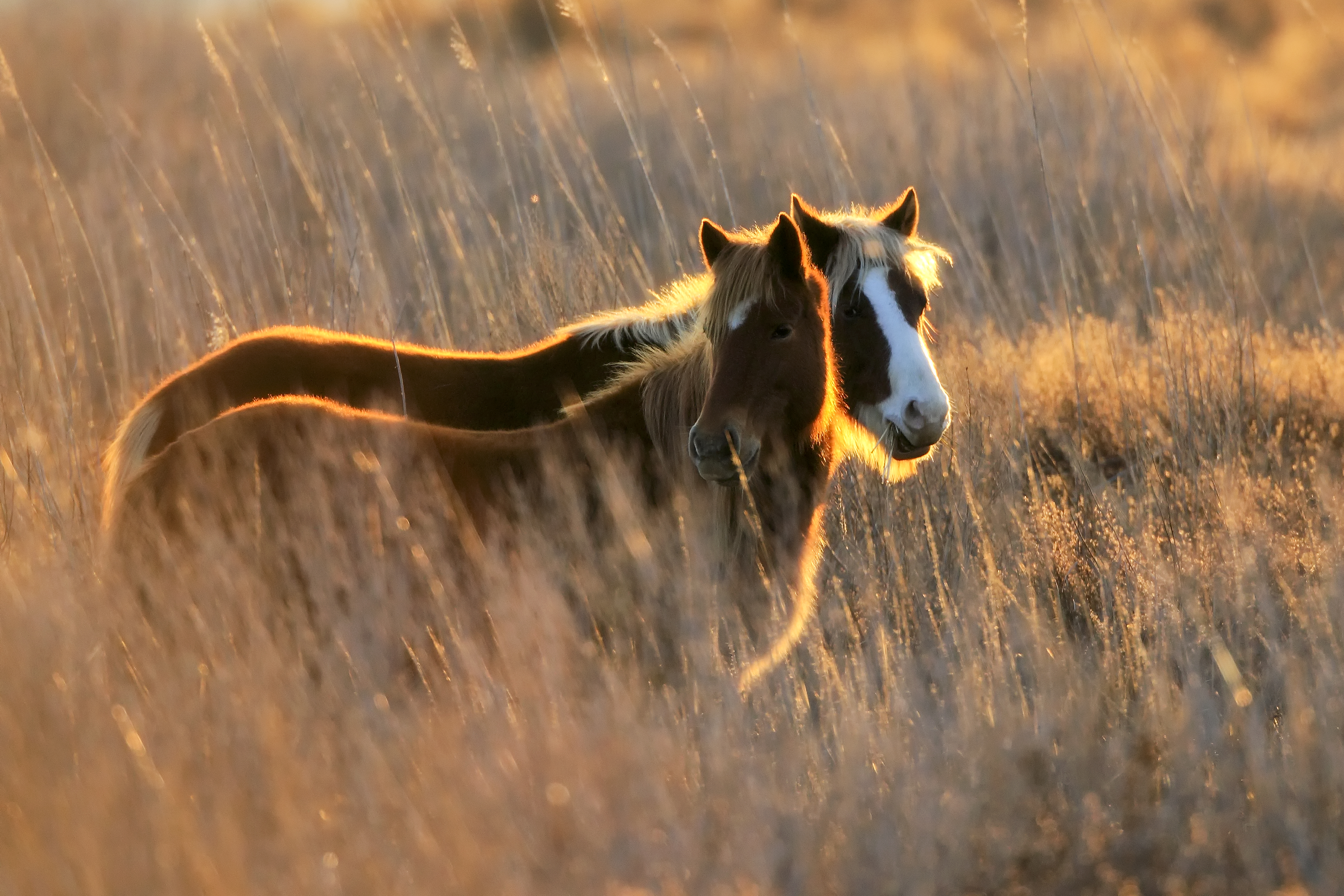
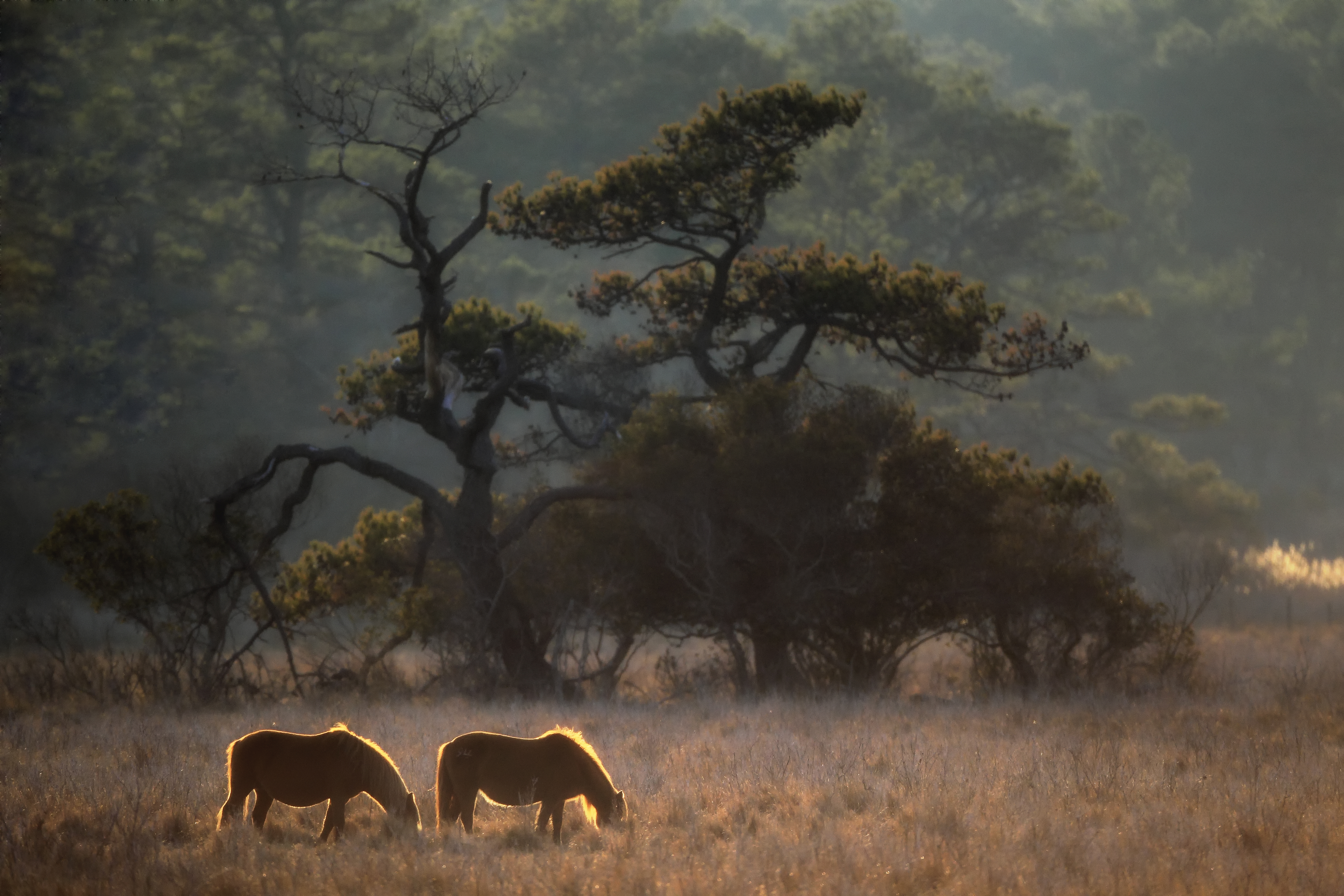
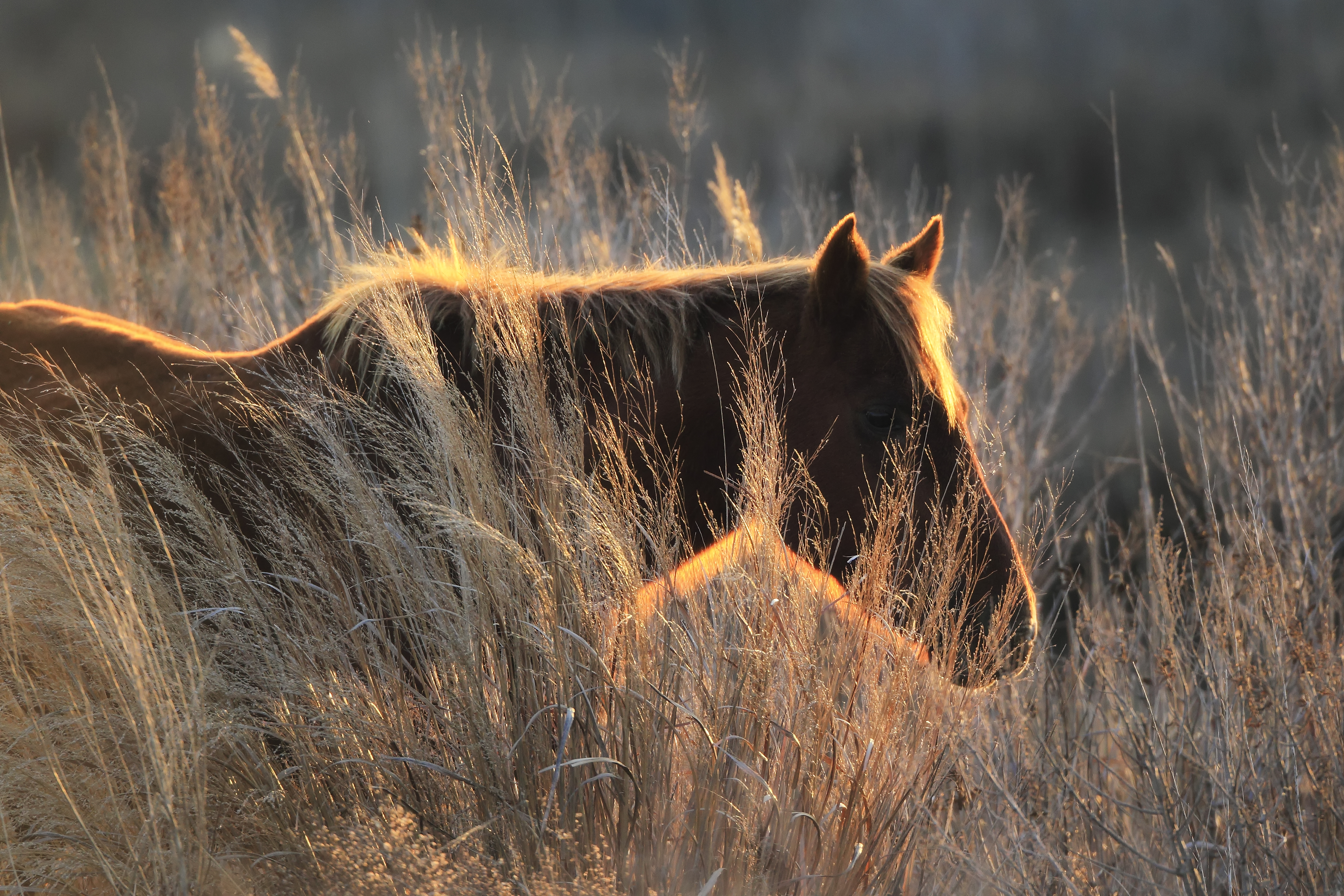
The Chincoteague ponies are the most visible example of this system. They are rarely still for long. They graze, reposition, interact in small social groups, and move in response to subtle environmental shifts. The strongest photographs happen when you observe first—watching how they space themselves, how they align with wind direction, and how they use the landscape for protection and feeding.
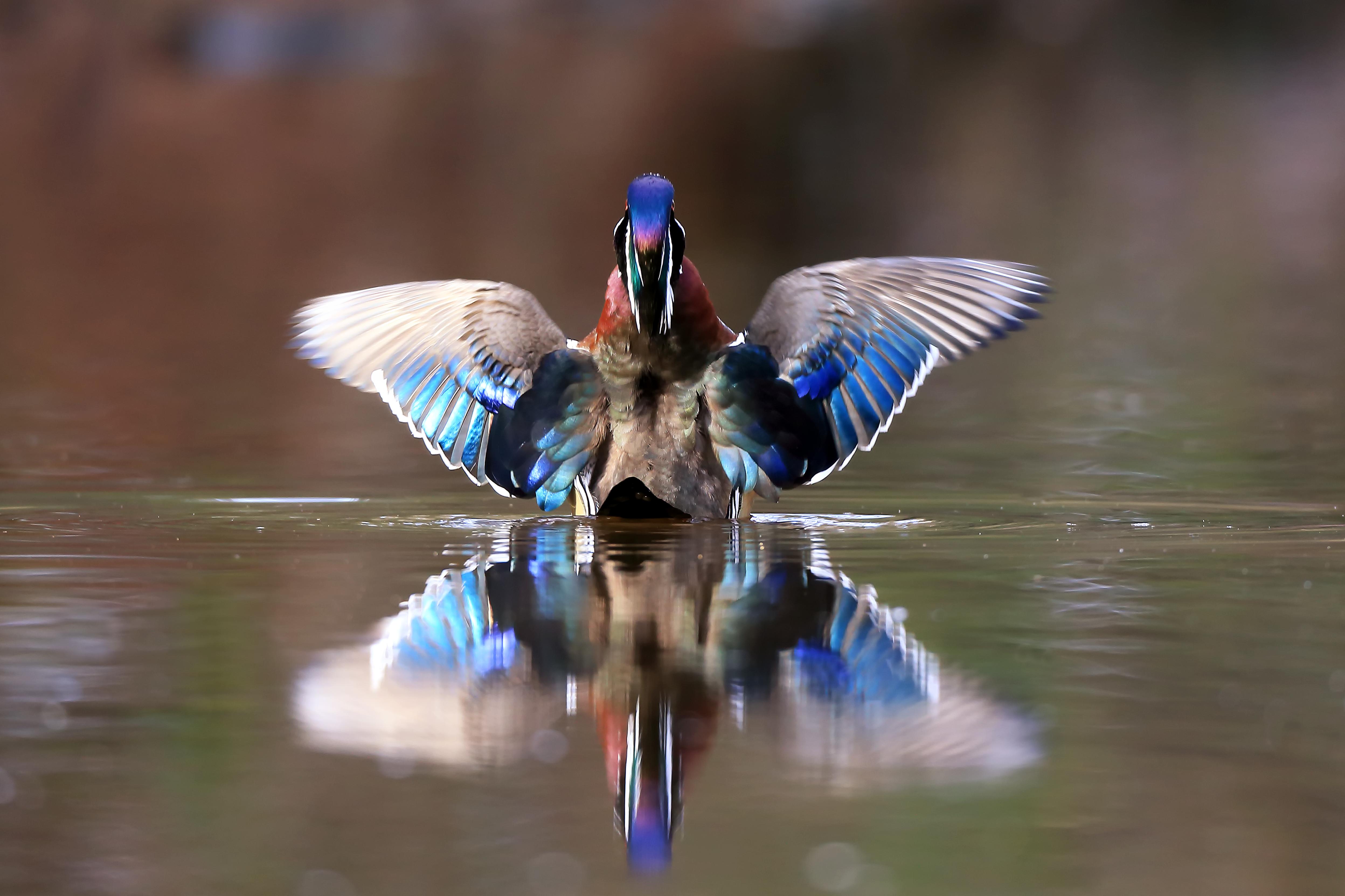
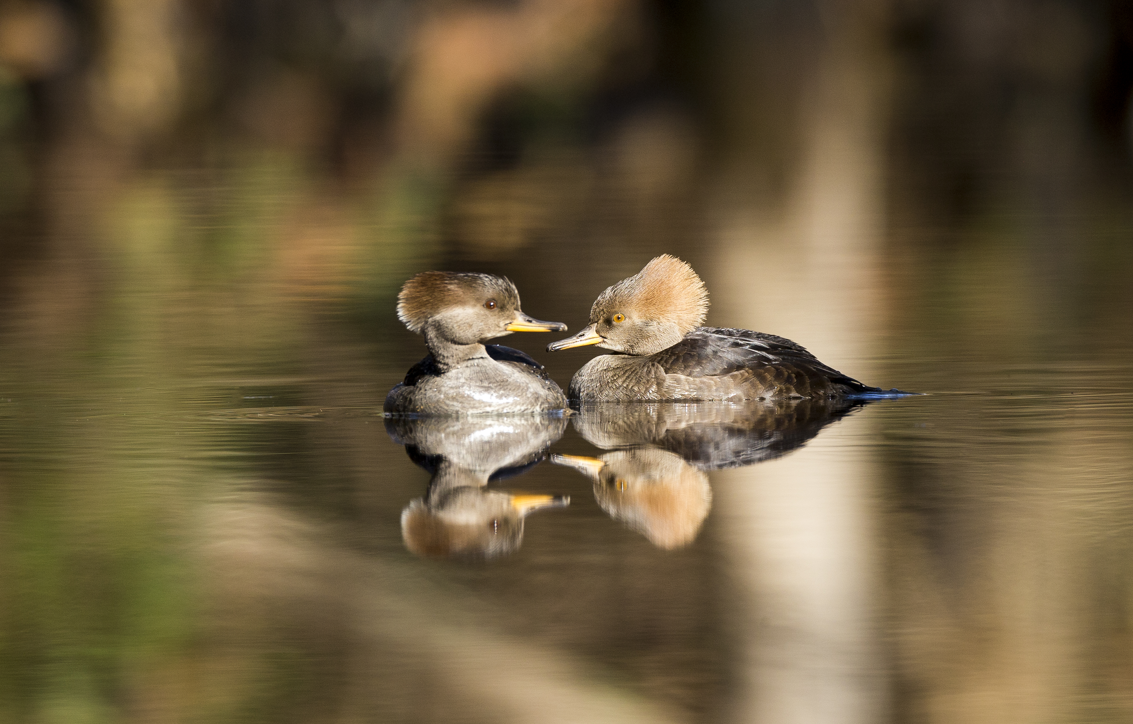
Birds bring a different kind of movement to the refuge. Along the Atlantic Flyway, Chincoteague becomes a stopover, a feeding ground, and a transition zone all at once. Wading birds track shallow water edges. Raptors patrol open air and shoreline. Waterfowl gather in shifting numbers depending on season. If you align your timing with migration patterns, you begin to see the refuge not as a static place, but as part of a much larger continental system.
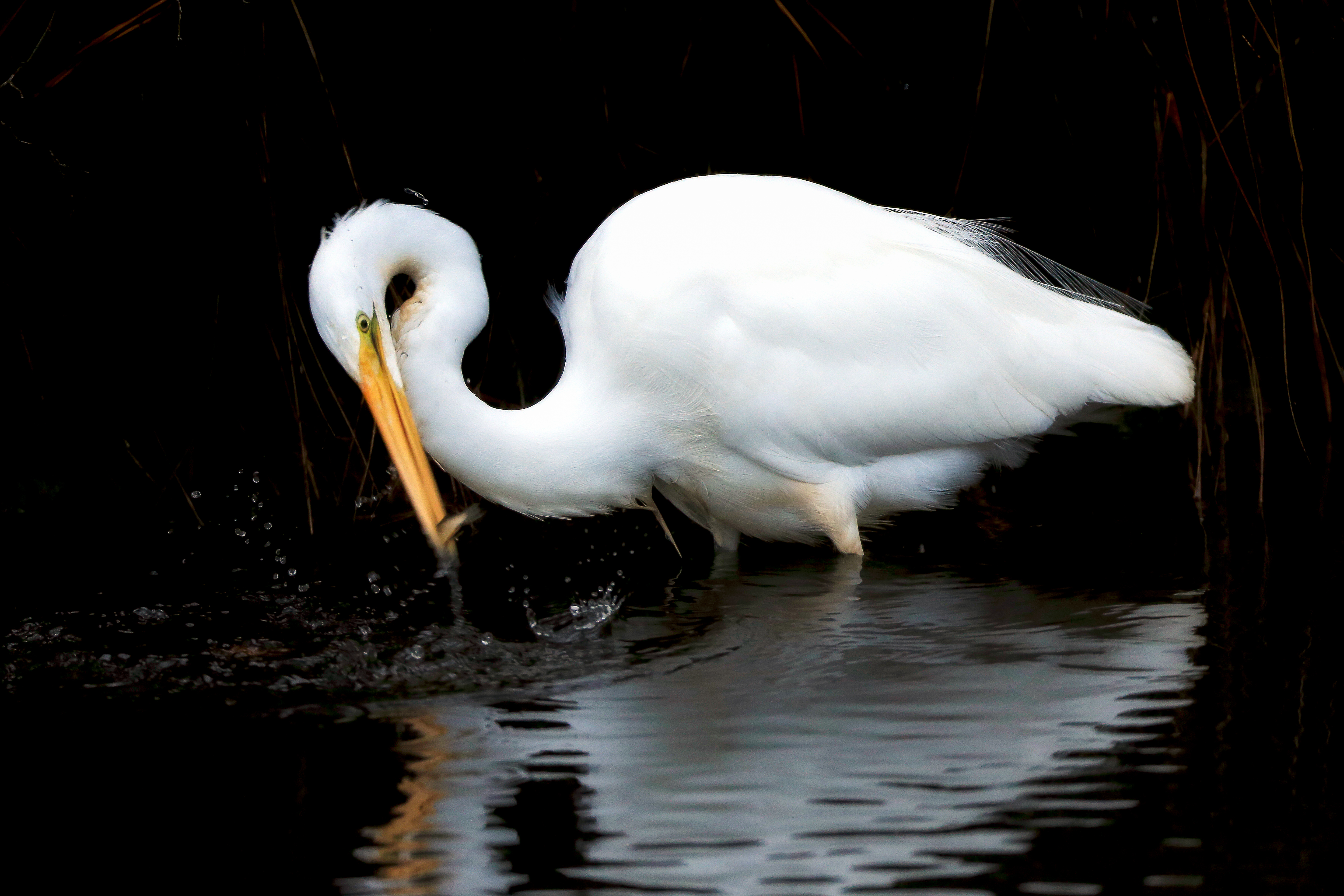
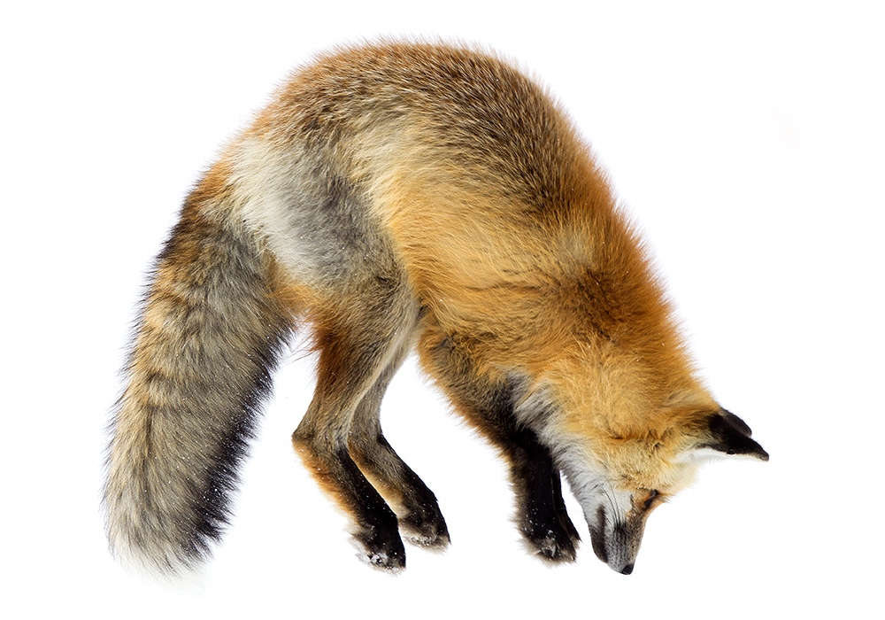
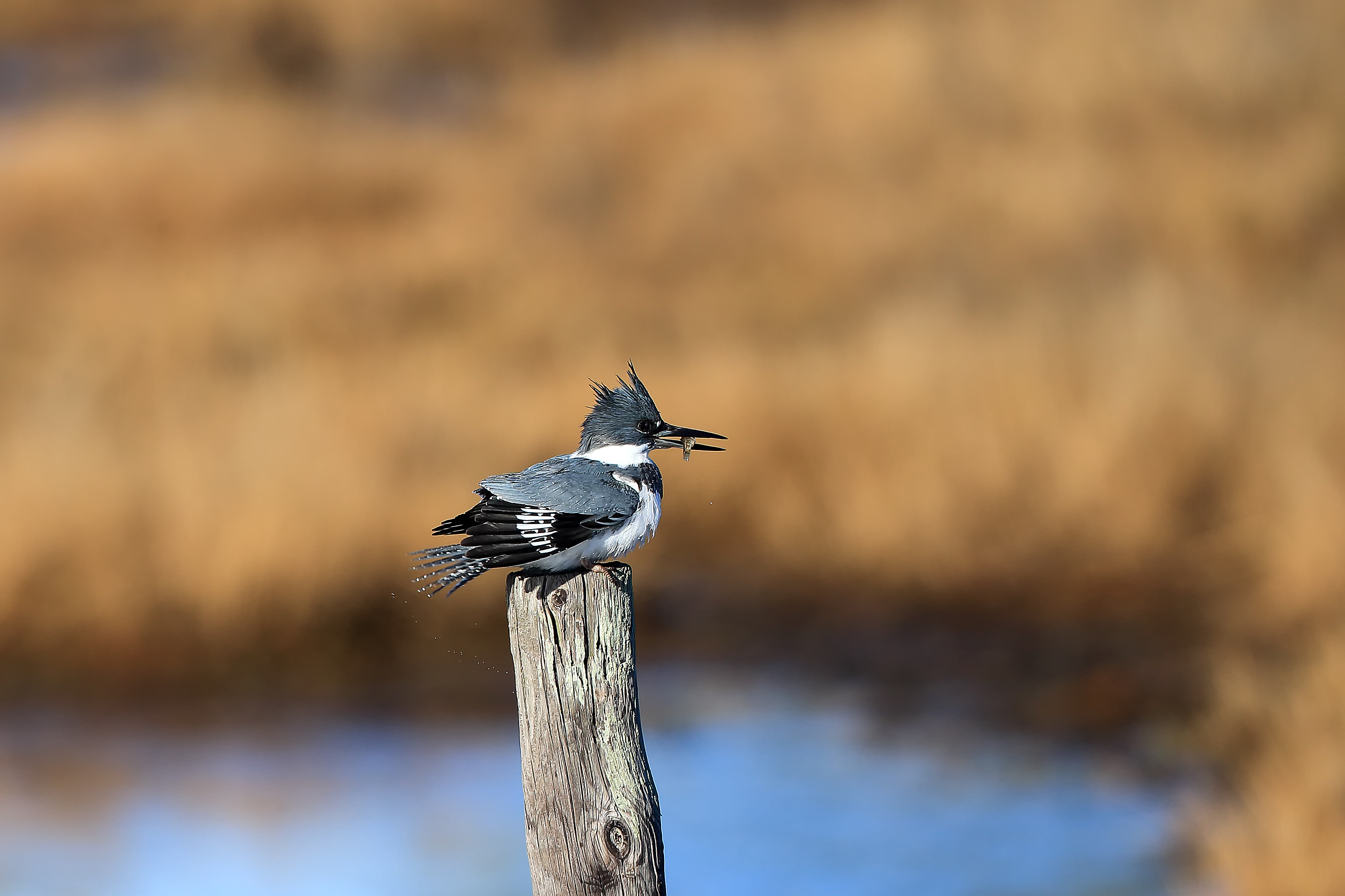
Even the smaller, less obvious species add depth to the behavioral picture. Kingfishers, herons, amphibians, and insects all respond to water level, vegetation density, and seasonal change. These interactions connect directly into broader concepts like biodiversity and ecosystem balance and wildlife adaptation and survival. The refuge is constantly showing how species adjust to pressure, resource availability, and environmental change.
“Wildlife doesn’t perform—it responds. If you understand what it’s responding to, you’ll know where to be before the moment happens.”
~ Robbie George
Seasonal Timing — How Chincoteague Changes Across the Year
Chincoteague is not the same place from one month to the next. The refuge shifts with migration, plant growth, water levels, and weather patterns. Understanding that seasonal timing is what separates random visits from consistent field success. If you align your visits with the natural rhythm of the refuge, everything—from wildlife presence to light quality—becomes more predictable and more powerful.
In spring, the refuge comes alive with movement. Migratory birds return along the Atlantic Flyway, vegetation begins to grow, and activity increases across marsh and shallow water. This is one of the best times to connect with your broader seasonal wildlife calendar and track how behavior aligns with temperature and daylight changes.
Summer brings longer light, dense vegetation, and the most famous cultural event in the refuge—the Pony Penning and swim. Wildlife is still active, but heat, insects, and thicker growth make observation more selective. Early morning and late evening become essential. This is when discipline in timing matters most.
Fall is one of the most balanced seasons. Migration builds again, temperatures drop, vegetation opens up, and the refuge becomes easier to read. Light quality improves dramatically, making this one of the strongest times for photography. You can connect this directly into your Nature’s Seasons framework—where behavior, color, and movement all align.
Winter strips the refuge down to its structure. Fewer crowds, open visibility, and strong bird concentrations—especially waterfowl and raptors—make this a powerful time for observation. The quiet conditions reveal patterns that are harder to see in busier seasons.
Across all seasons, the key is consistency. The more you return, the more the refuge reveals its timing. This is not a place you “check off.” It is a place you learn over time—where season, light, and behavior begin to connect into one continuous system.
“The season doesn’t just change what you see—it changes how the land reveals itself.”
~ Robbie George
Locations & Field Strategy — Where to Position Yourself in the Refuge
Chincoteague is not a place where you wander without intention and expect consistent results. The refuge rewards positioning. Knowing where to stand, when to be there, and how the land shapes movement is what turns a visit into a productive field session. I treat this refuge as a series of connected zones—each with its own light, behavior patterns, and timing windows.
The Wildlife Loop is the core circuit. It gives access to marsh edges, shallow impoundments, and open viewing corridors where ponies, waterfowl, and wading birds regularly appear. Early morning here is critical—before wind builds and before human pressure increases. The loop works best when you move slowly and scan constantly rather than rushing from one point to another.
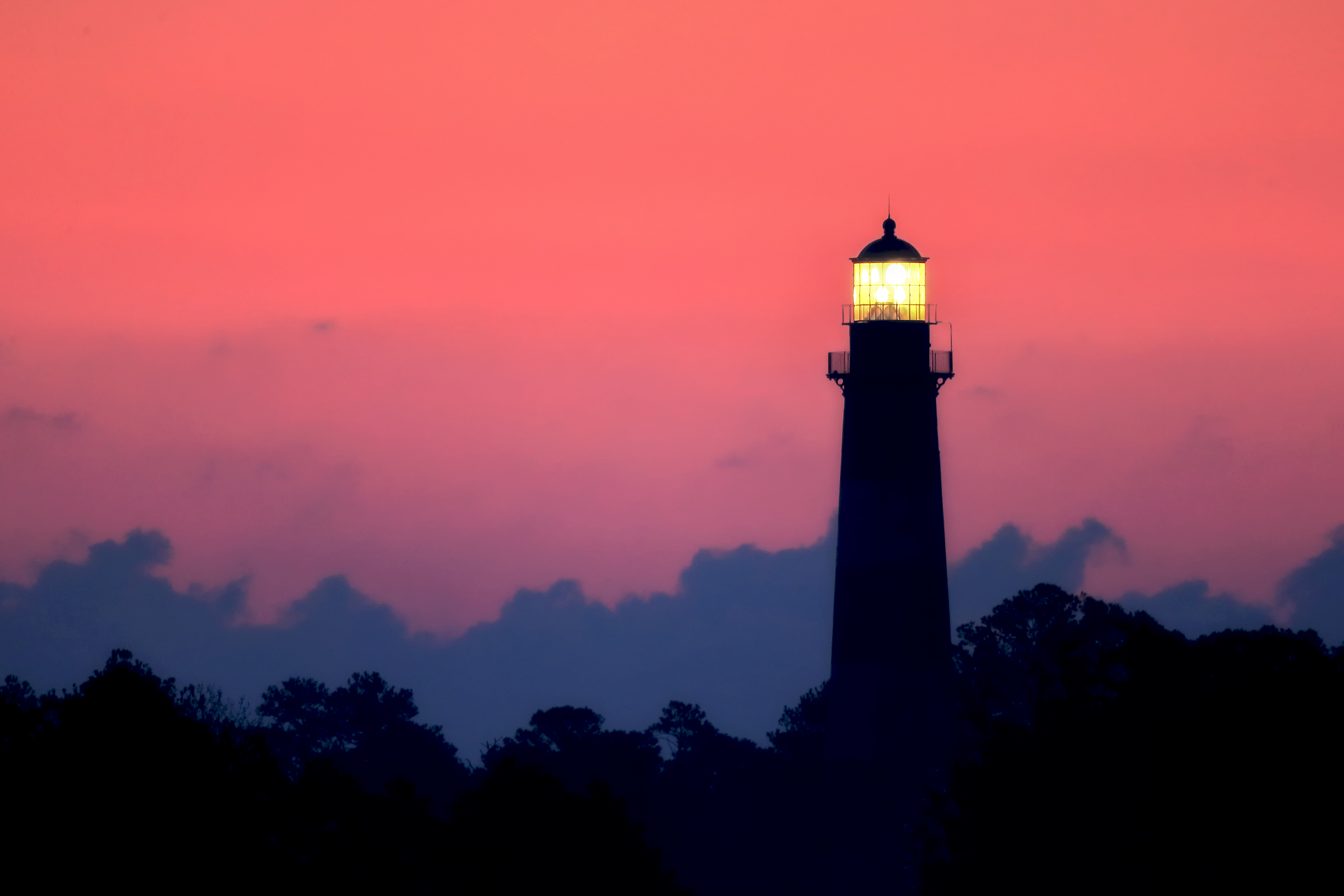
The Assateague Channel and lighthouse area provide strong compositions with water, reflection, and sky alignment. This is where I look for sunrise structure—light breaking across water, birds in flight, and layered coastal depth. The beach and dune system offers a completely different environment, with wind-driven patterns, shorebirds, and more minimal compositions tied to landscape photography.
One of the most overlooked strategies is simply using elevation and distance. Slight changes in height—whether from overlooks, road edges, or natural rises—change your entire field of view. Combine that with patience, and you begin to see how wildlife moves through the refuge rather than just where it appears.
Prefer full screen? Open the Chincoteague Photography Map ↗
This map represents how I approach the refuge—connecting location to light, behavior, and access. It is not just a navigation tool. It is a field strategy layer. Each point is chosen based on repeated observation and how wildlife interacts with that specific piece of habitat.
“Where you stand matters as much as what you see. Position is the first decision every photograph depends on.”
~ Robbie George
Planning & Field Ethics — How to Move Through Chincoteague Responsibly
Planning at Chincoteague starts with understanding that this is a sensitive coastal system. Weather shifts quickly, insects can be intense, and wildlife responds immediately to human pressure. Before I even step into the refuge, I’m thinking about wind direction, tide conditions, temperature, and how early I need to arrive to work with the best light and least disturbance.
The most important principle here is simple: distance first. The ponies, birds, and other wildlife are not subjects to approach—they are part of a system to observe. A telephoto lens allows you to stay back and still create strong images. If an animal changes behavior because of your presence, you’re too close. This approach aligns directly with your wildlife observation field techniques and reinforces ethical field practice across all locations.
Staying on designated paths and observation areas is just as important. The dunes, marsh edges, and nesting zones are fragile environments. Stepping off-trail can damage vegetation, disturb breeding areas, and disrupt the very behavior you came to observe. Respecting these boundaries is part of wildlife conservation and habitat protection.
Preparation also matters. Bring layers for changing coastal weather, insect protection in warmer months, and gear that can handle moisture and salt air. Use tools like your Golden Hour & Moon Planner and Field Tools to align your timing with light, conditions, and wildlife activity.
Ultimately, Chincoteague rewards patience and awareness more than anything else. Move slowly. Watch before shooting. Let behavior unfold naturally. When you work with the system instead of against it, the refuge gives you far more than just images—it gives you understanding.
“Respect creates access. The more you honor distance, the more the wild allows you to see.”
~ Robbie George
Naturepedia Connection — Chincoteague as a Living Coastal System
Chincoteague National Wildlife Refuge is not just a location—it is a fully connected ecological system. When viewed through the lens of Naturepedia, the refuge becomes a clear example of how habitat, behavior, season, and conservation interact continuously across a landscape.
The barrier island structure creates a layered environment where salt marsh, dune systems, shallow wetlands, and maritime forest all connect. These habitats support feeding, nesting, migration stopover, and shelter. This aligns directly with your broader framework of wildlife habitats and ecosystem zones, where transitions between environments create the highest concentration of life and activity.
Behavior here is driven by that structure. Ponies follow vegetation and water access. Birds track depth, tide, and seasonal migration. Predators and smaller mammals use edge zones for movement and cover. These patterns connect directly to wildlife behavior and ecology and demonstrate how species respond to environmental pressure in real time.
Season adds another layer. Migration cycles bring waves of birds through the refuge, vegetation shifts change visibility and feeding patterns, and weather reshapes water levels and access. This reinforces the importance of migration and seasonal timing as core drivers of ecological understanding.
Conservation is the stabilizing force that allows all of this to continue. Without habitat protection, water management, and responsible human interaction, the system would quickly degrade. Chincoteague stands as a strong example of wildlife conservation and habitat stewardship working in balance with public access.
When you connect all of these layers—habitat, behavior, season, and conservation—you begin to see the refuge clearly as a living node within a larger ecological network. This is the core of Naturepedia: understanding that every location is not isolated, but part of a continuous system linking species, landscapes, and time.
“A place becomes clear when you stop seeing it as a destination and start seeing it as a system.”
~ Robbie George
Chincoteague National Wildlife Refuge — Field FAQ
What is the best time of year to visit Chincoteague?
Spring and fall are the strongest seasons for wildlife activity and photography due to migration and moderate conditions. Summer offers the pony swim and longer light, while winter provides quieter access and strong waterfowl presence.
Where are the best locations for wildlife photography?
The Wildlife Loop is the most consistent zone for ponies and bird activity. The Assateague Channel and lighthouse area offer strong sunrise compositions, while beach and dune areas provide shoreline wildlife and landscape opportunities.
What gear should I bring for photographing wildlife here?
A telephoto lens (300mm or longer) is essential for maintaining distance. A tripod helps in low light, and a polarizing filter is useful for managing reflections on water. Weather-resistant gear is recommended due to coastal conditions.
How close can I get to the ponies and wildlife?
Always maintain a safe and respectful distance. Use your lens instead of approaching. If an animal changes behavior because of your presence, you are too close. Distance is essential for both safety and ethical observation.
How does Chincoteague connect to the broader wildlife system?
The refuge is part of the Atlantic Flyway and functions as a key migration stopover, feeding ground, and habitat system. It connects directly to broader patterns of wildlife behavior, ecosystems, and seasonal movement across North America.
What is the most important field tip for visiting Chincoteague?
Slow down. Observe first. Let the landscape and wildlife behavior guide your movement rather than chasing subjects. The best moments come from patience and awareness, not speed.
About Robbie George
I’m Robbie George, a National Geographic–published photographer working from a field-first approach—returning to places over time, observing how light, behavior, and landscape interact, and building understanding through direct experience rather than assumption.
Chincoteague is one of those locations that rewards that approach. The more time I spend here, the more clearly the system reveals itself—from pony movement across marsh edges to bird behavior shaped by tide and migration. It’s a place where patience consistently outperforms effort, and where the strongest images come from understanding how the land works.
My work connects individual locations like this into a larger system through Naturepedia, linking species, behavior, ecosystems, and seasonal timing into one continuous field-based knowledge structure.
You can explore more through my wildlife photography gallery, or use tools like the Field Tools and Golden Hour Planner to plan your own time in the field.
“The photograph is not the moment—it is what the moment reveals after you learn how to see it.”
~ Robbie George