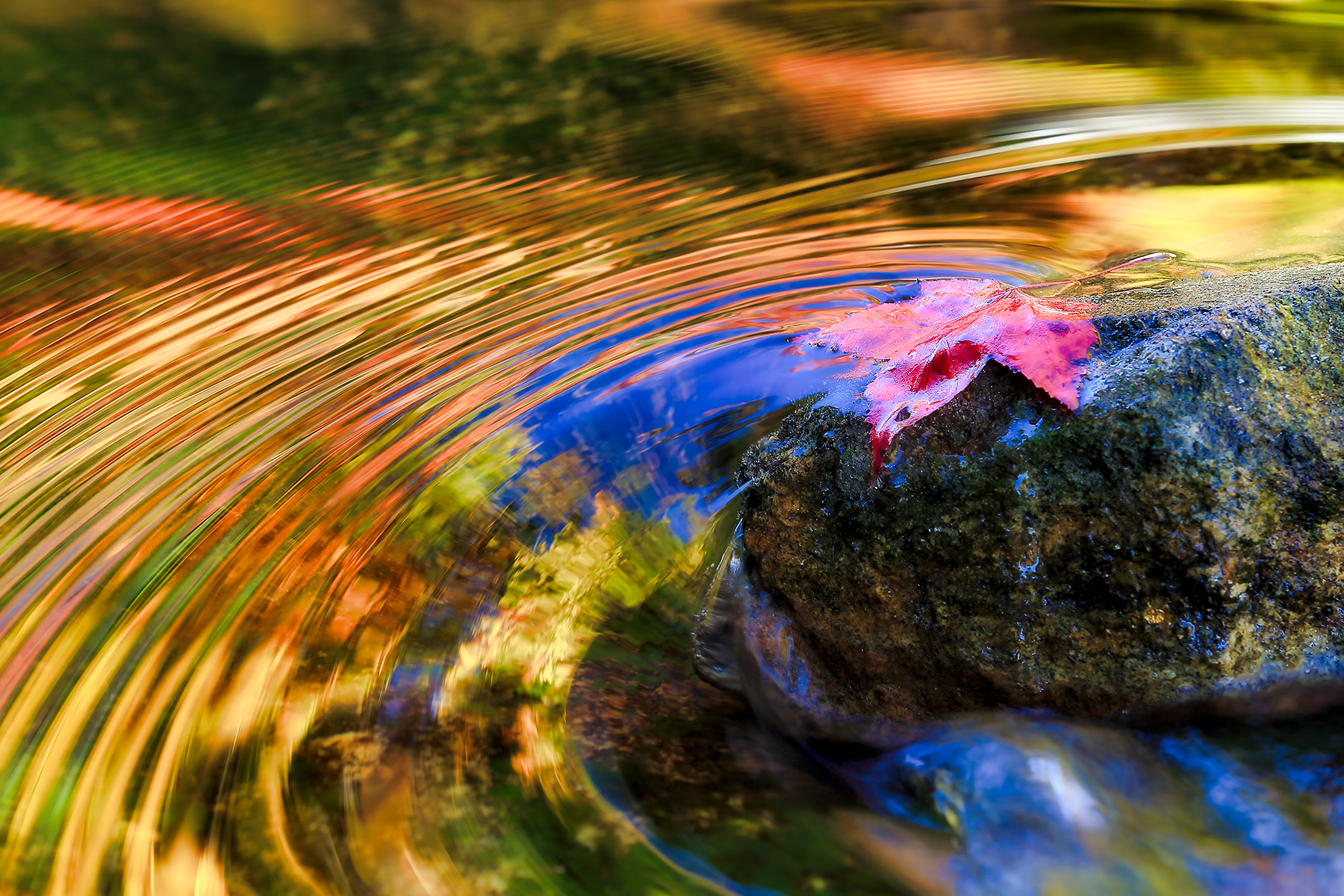
🌿 Interactive maps for nature photographers: destinations, timing, and vantage points—all in one place.
Explore Nature & Wildlife Photography Maps
Over the years, I’ve returned again and again to places like Yellowstone, Grand Teton, Bosque del Apache, Chincoteague, Aransas, and the rocky coasts of Maine and Nova Scotia—not just to photograph them, but to learn how light, weather, habitat, and timing shape what becomes possible there. In the field, a map is never just about getting somewhere. It helps reveal where wildlife moves, where landscapes open, and where a brief moment of alignment can turn into a meaningful photograph.
This page brings together the locations I’ve explored and the routes I’ve used to understand them better—from migration corridors and refuge roads to coastal pullouts, alpine overlooks, and seasonal wildlife hotspots. Use these maps to plan with more clarity, connect location with season, and move from inspiration into real field preparation.
Field-tested maps designed to connect place, season, wildlife behavior, and photographic opportunity across the landscapes I’ve returned to most.
Featured Field Locations — Where Wildlife, Habitat, and Light Come Together
These are places I’ve returned to repeatedly—locations where patterns become visible over time. Each map reflects not just where to go, but how wildlife movement, habitat structure, and changing light come together in the field.
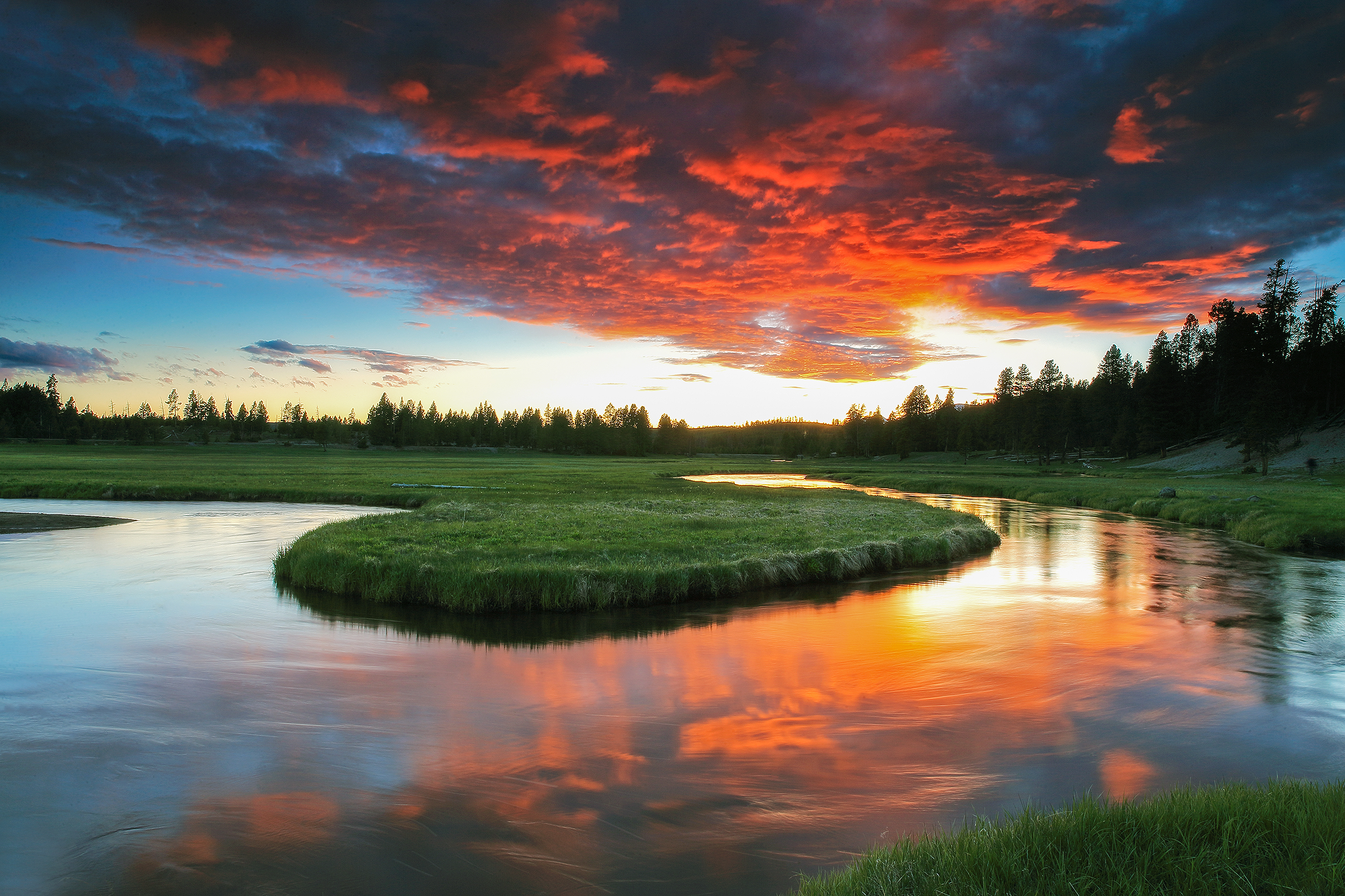
In places like Lamar Valley and Hayden Valley, wildlife movement follows terrain, pressure, and season. This map highlights key corridors for wolves, elk, and bears, along with geothermal areas where wildlife, weather, and open country often create strong photographic opportunities.
Best for: predator-prey dynamics, open valley movement, winter tracking, and large-scale wildlife behavior
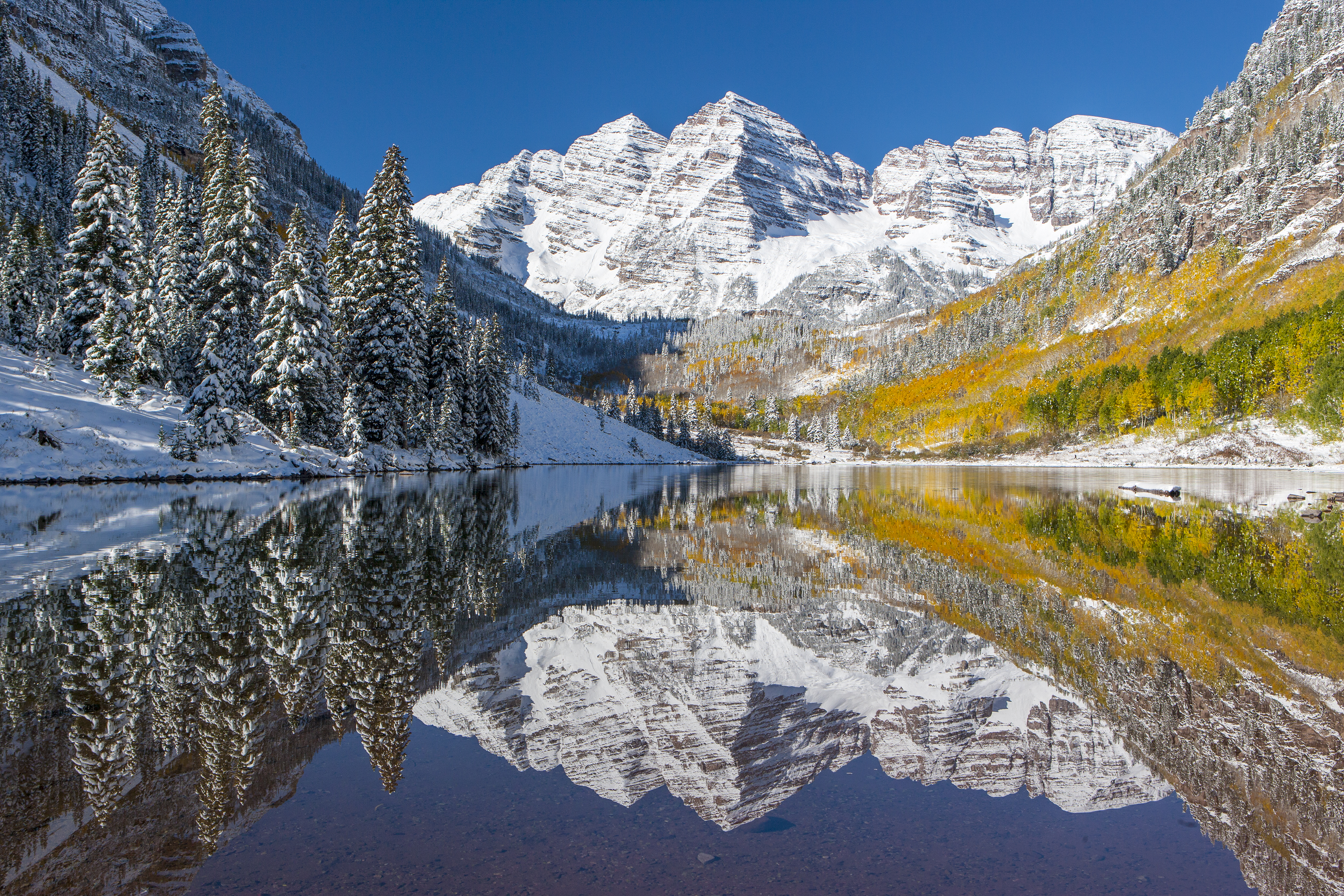
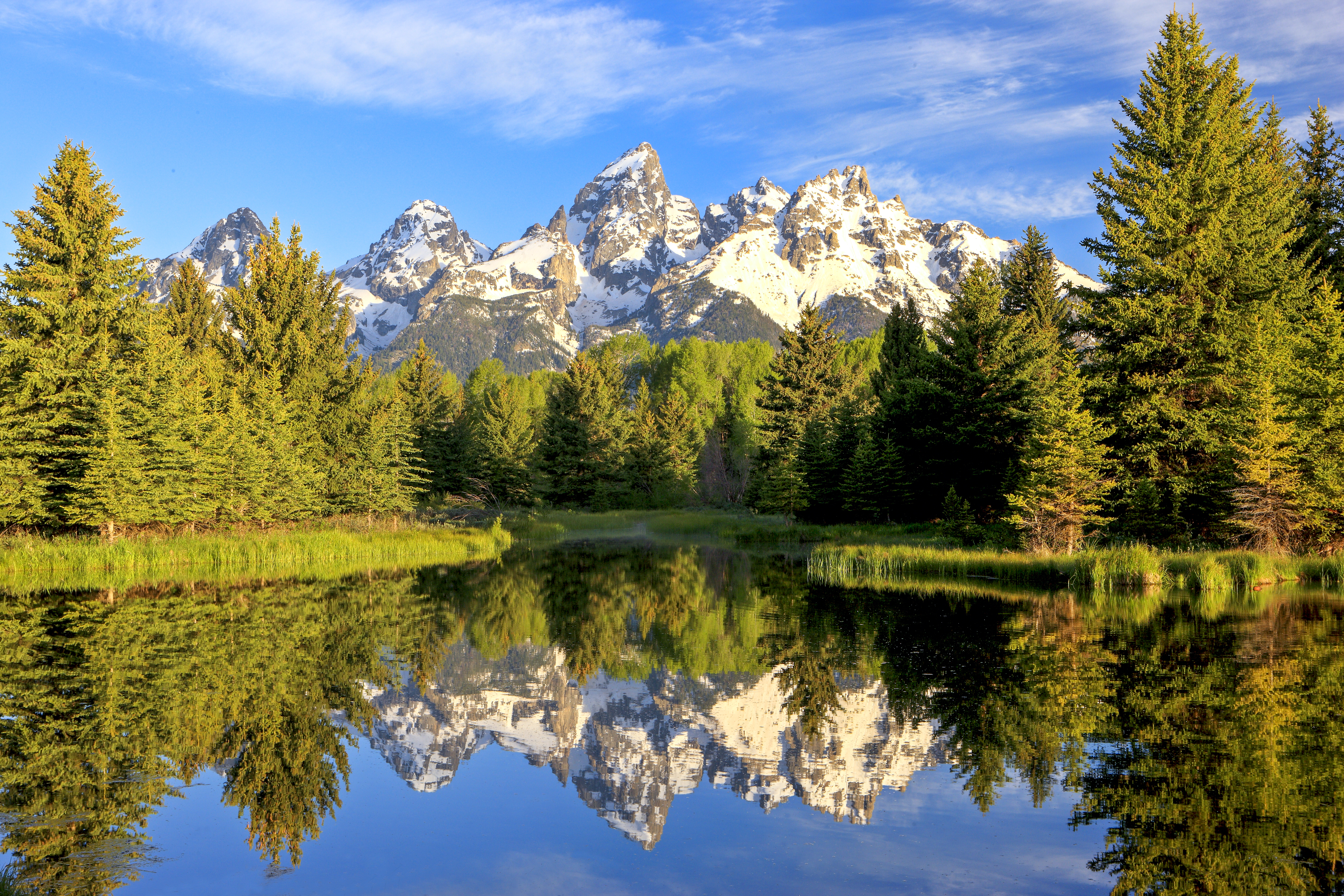
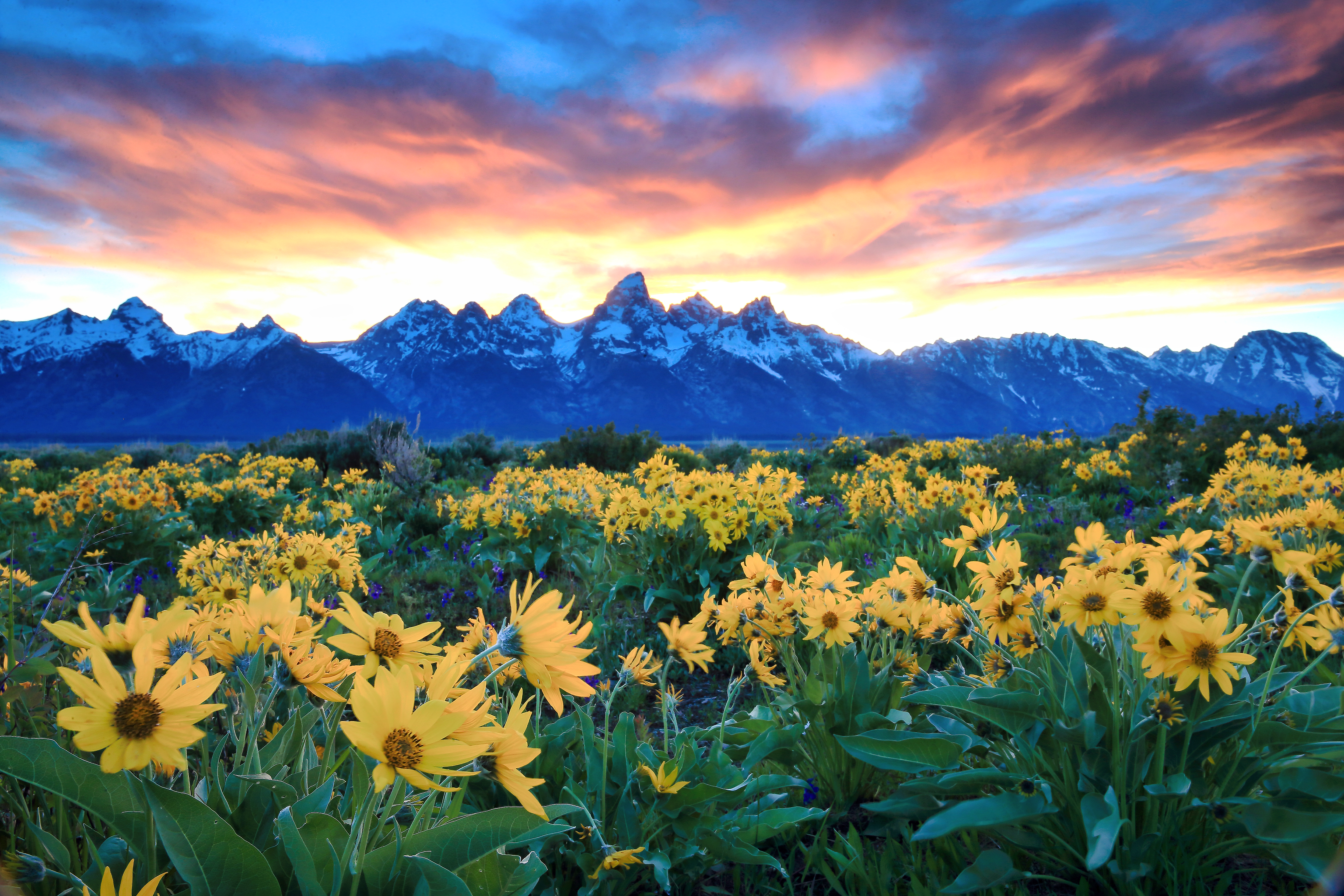
Here, elevation and light define almost everything. From Oxbow Bend to Schwabacher Landing, this map focuses on reflective water, dawn alignment, and wildlife transitions between forest, wet meadow, and valley floor.
Best for: sunrise alignment, reflection compositions, moose habitat edges, and mountain-to-valley transitions
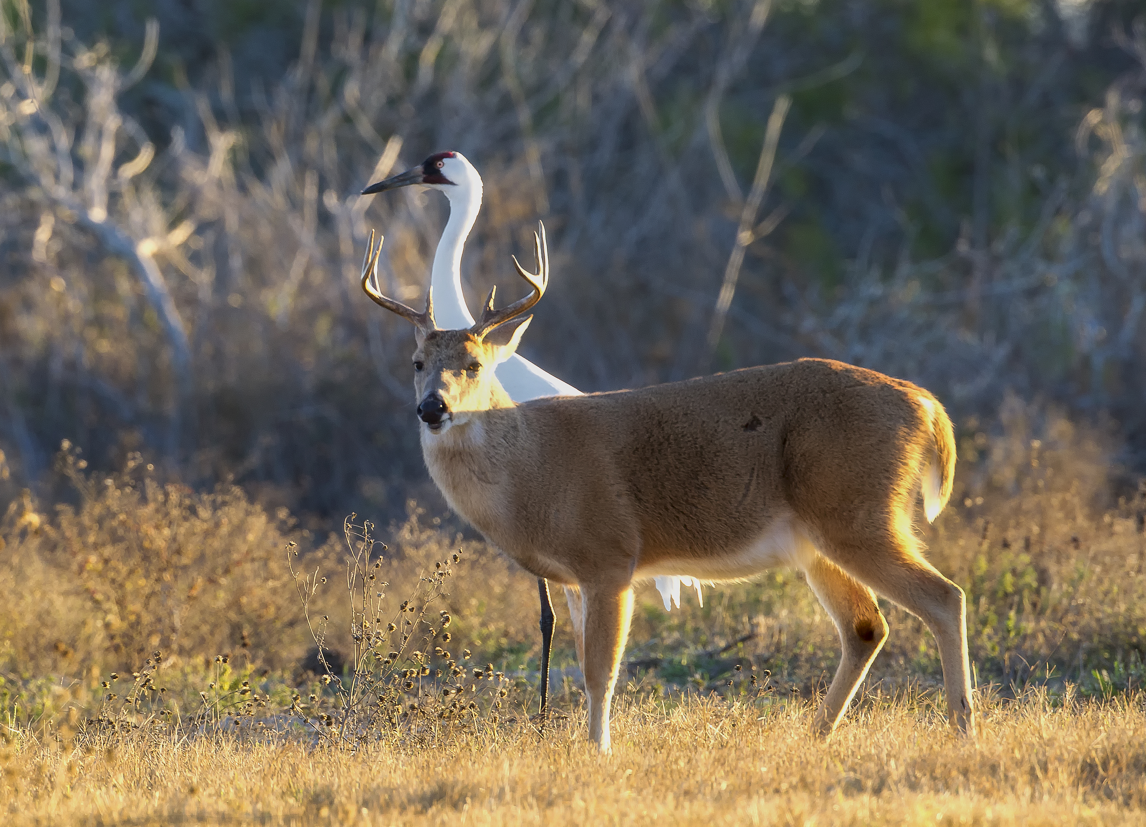
Along the Texas coast, tidal movement and winter migration converge. This map focuses on endangered whooping cranes, highlighting feeding zones, marsh structure, fly-in patterns, and the coastal light that shapes the refuge in colder months.
Best for: winter migration, whooping crane photography, coastal marsh light, and conservation-centered field planning
Barrier island ecology creates constant movement between land and water. This map highlights marsh edges, birding blinds, and wild pony ranges where behavior shifts with tide, wind, and seasonal migration along the coast.
Best for: coastal bird behavior, tidal timing, layered habitat transitions, and refuge-based wildlife observation
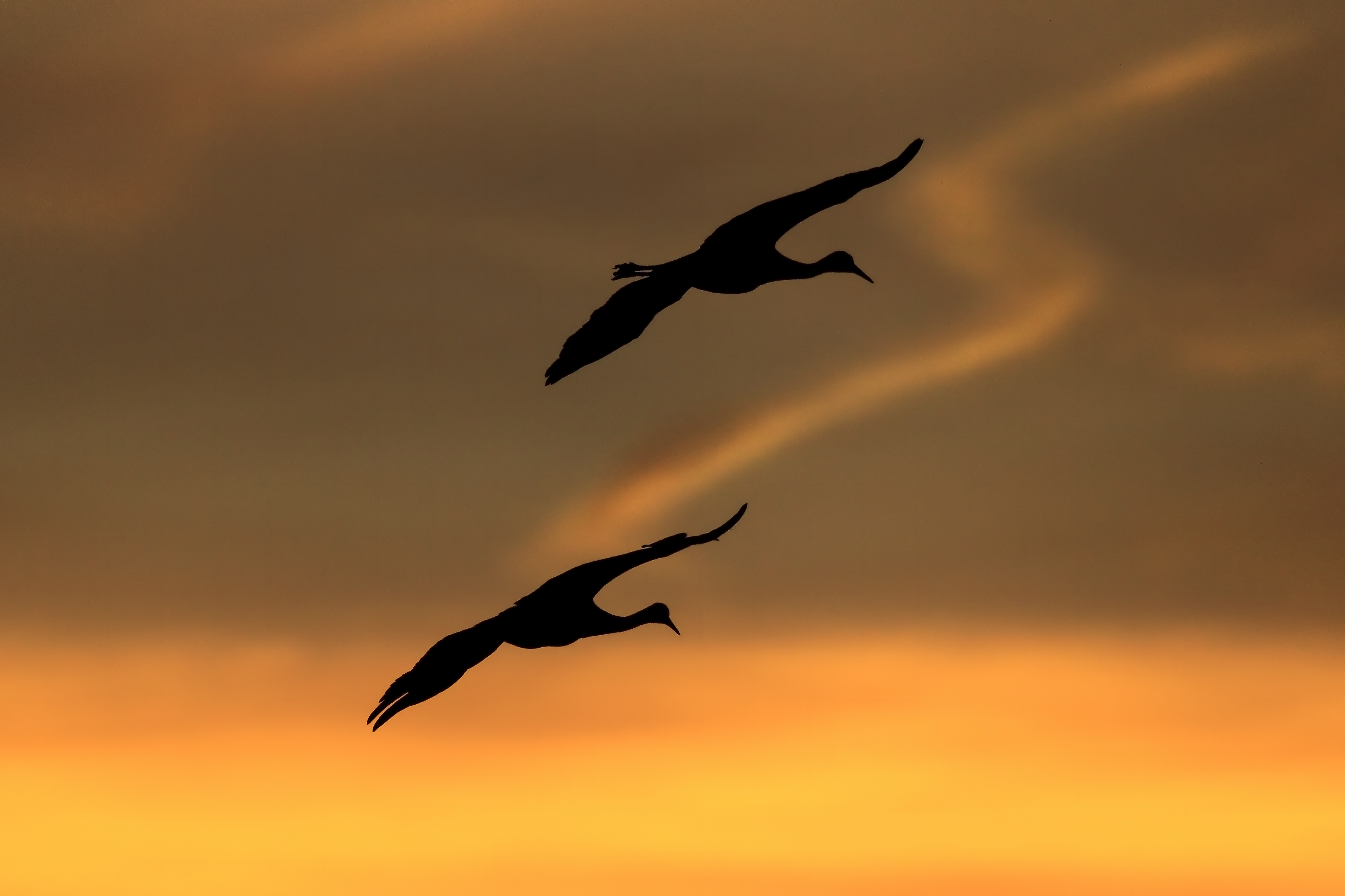
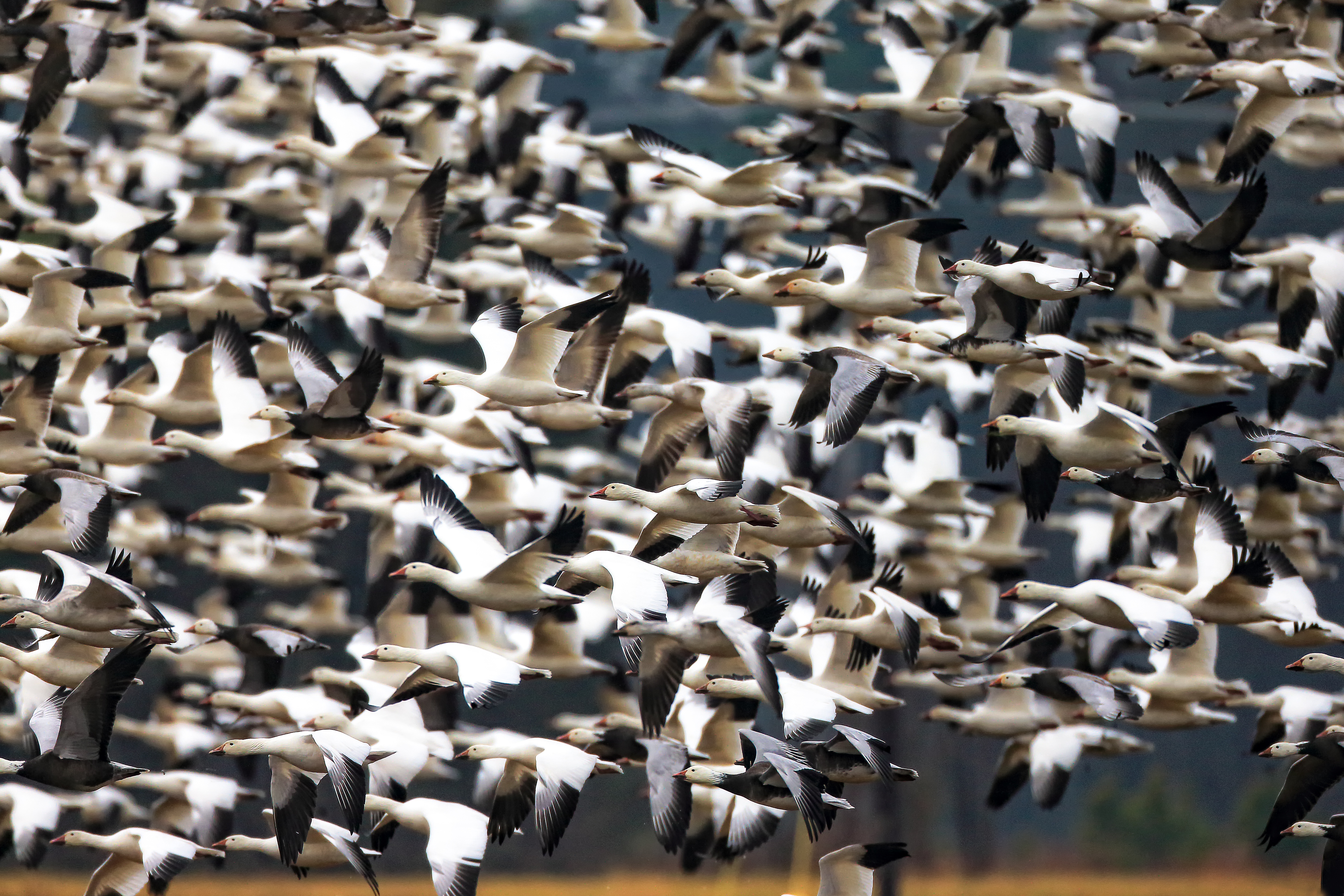
Few places reveal migration timing as clearly as Bosque. This map follows sandhill crane and snow goose movement across impoundments, with sunrise blast-offs, evening returns, and concentrated wetland behavior defining the rhythm of the refuge.
Best for: migration concentration, crane and goose flight patterns, sunrise behavior, and seasonal refuge strategy
These places are defined by the wildlife that moves through them. Knowing what to look for—and how to read movement—turns a location into an opportunity.
Field insight: the best maps don’t just show where to go—they help you understand what patterns are unfolding when you get there.
Best Time to See Each Species
Wildlife visibility changes with season, habitat, migration, breeding behavior, food availability, and weather. Use this guide as a seasonal starting point, then pair each species with the maps, location pages, and field tools for more precise planning.
Planning insight: the best season is not just about visibility — it is about behavior. A species becomes easier to photograph when movement, habitat, light, and timing line up.
Seasonal Movement — Where Timing Changes Everything
Wildlife doesn’t move randomly—it follows seasonal patterns tied to light, weather, food, breeding cycles, and survival. Over time in the field, I’ve learned that timing is often the difference between seeing very little and witnessing something unforgettable.
Spring is movement returning—bird migrations, nesting behavior, courtship activity, and wildflower emergence. This map highlights wetlands, flyways, meadow systems, and early-season habitats where life becomes visible again after winter.
Best for: migratory birds, nesting activity, wetland photography, and early-season wildlife behavior
Summer brings long light and peak activity—fawns, birds of prey, coastal wildlife, alpine movement, and full ecological productivity. This map focuses on elevation zones, shorelines, and feeding patterns that become especially active in the warmer months.
Best for: long light conditions, active wildlife, coastal ecosystems, and alpine field work
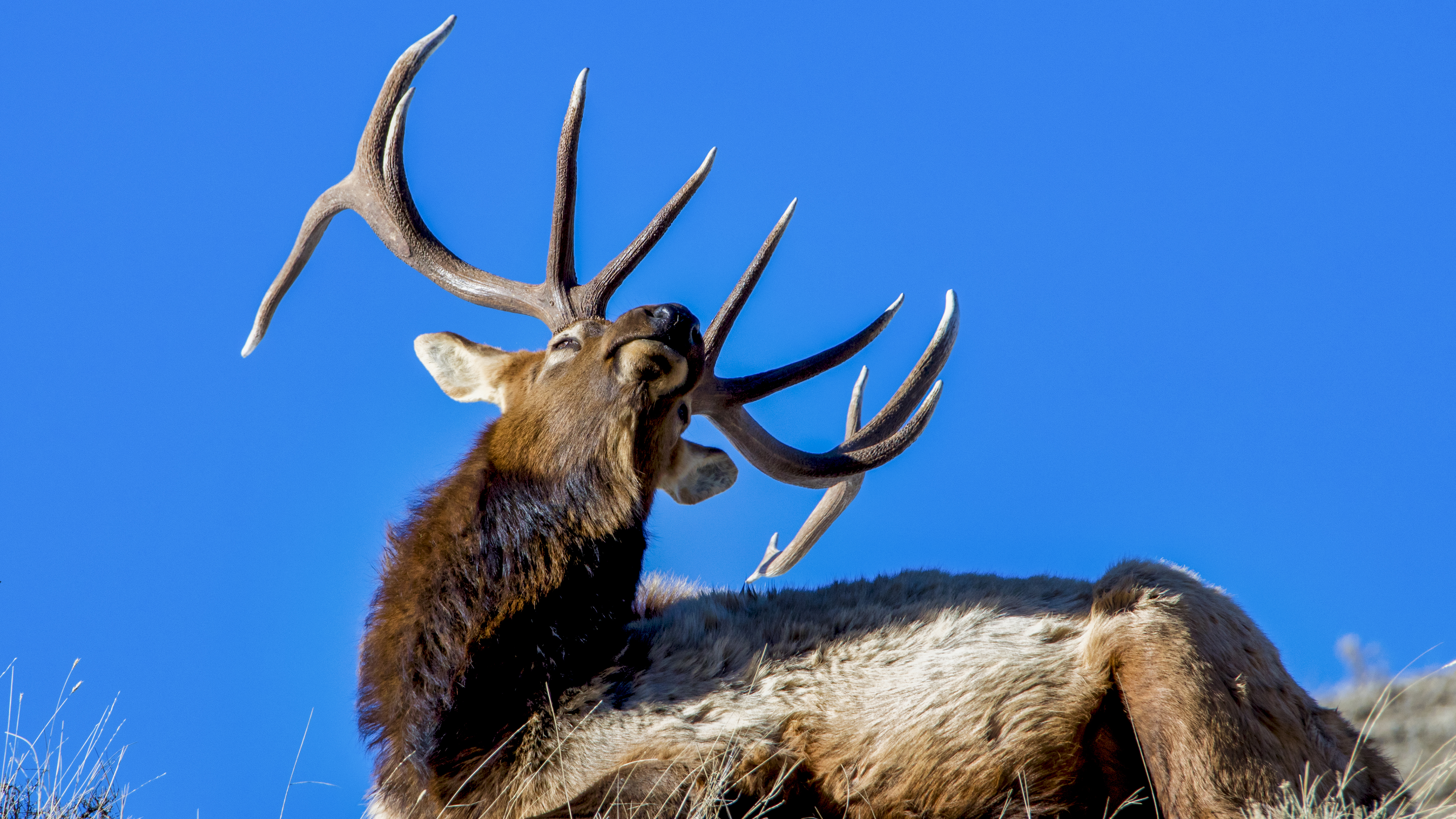
Autumn is a season of intensity—elk rut, peak foliage, migration turnover, and sharp behavioral change. This map tracks elevation-based color change and wildlife hotspots across North America where transition becomes especially visible.
Best for: elk rut, fall color timing, migratory change, and transitional wildlife behavior
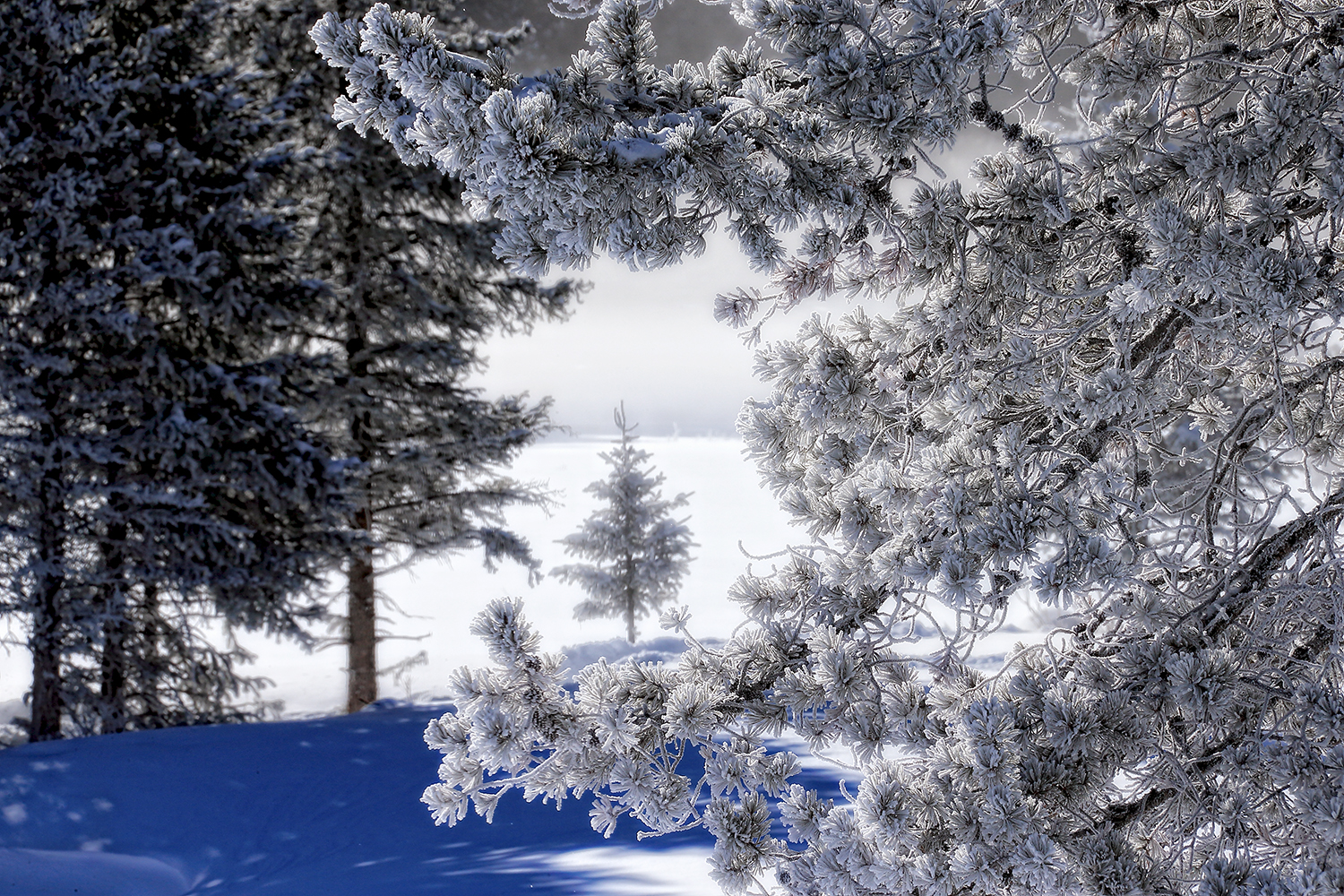
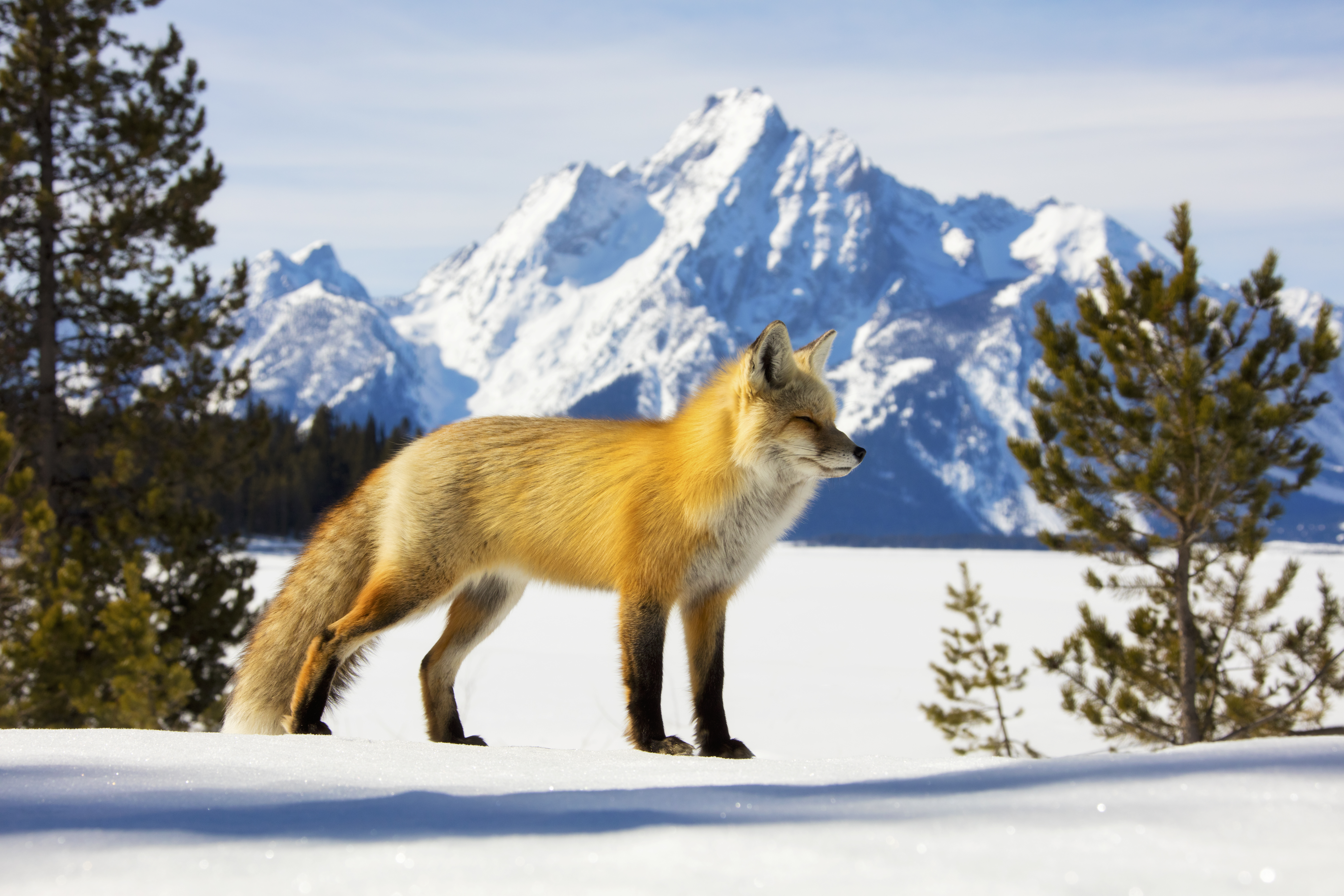
Winter simplifies the landscape and makes movement easier to read—revealing tracks, open-valley travel, predator-prey interaction, and concentrated cold-season habitat use. This map focuses on snowy landscapes, frozen wetlands, and wildlife concentration zones.
Best for: tracking wildlife, snowy compositions, winter raptors, fox encounters, and cold-season field planning
Specialized Maps — Species, Seasons, and Signature Places
Some places are best understood through a single species, a single season, or a very specific pattern of light and behavior. These maps narrow the focus, helping you plan around concentrated wildlife moments, coastal conditions, migration windows, and landscape opportunities that reward timing and repetition.
From bugling bulls in the Rockies to wintering herds in Yellowstone, this map follows places where elk behavior becomes especially visible. It is built around rut activity, cold-weather movement, and the open habitats where sound, breath, and body language carry across the landscape.
Best for: elk rut, winter herd movement, behavior-focused wildlife photography, and open-habitat field observation
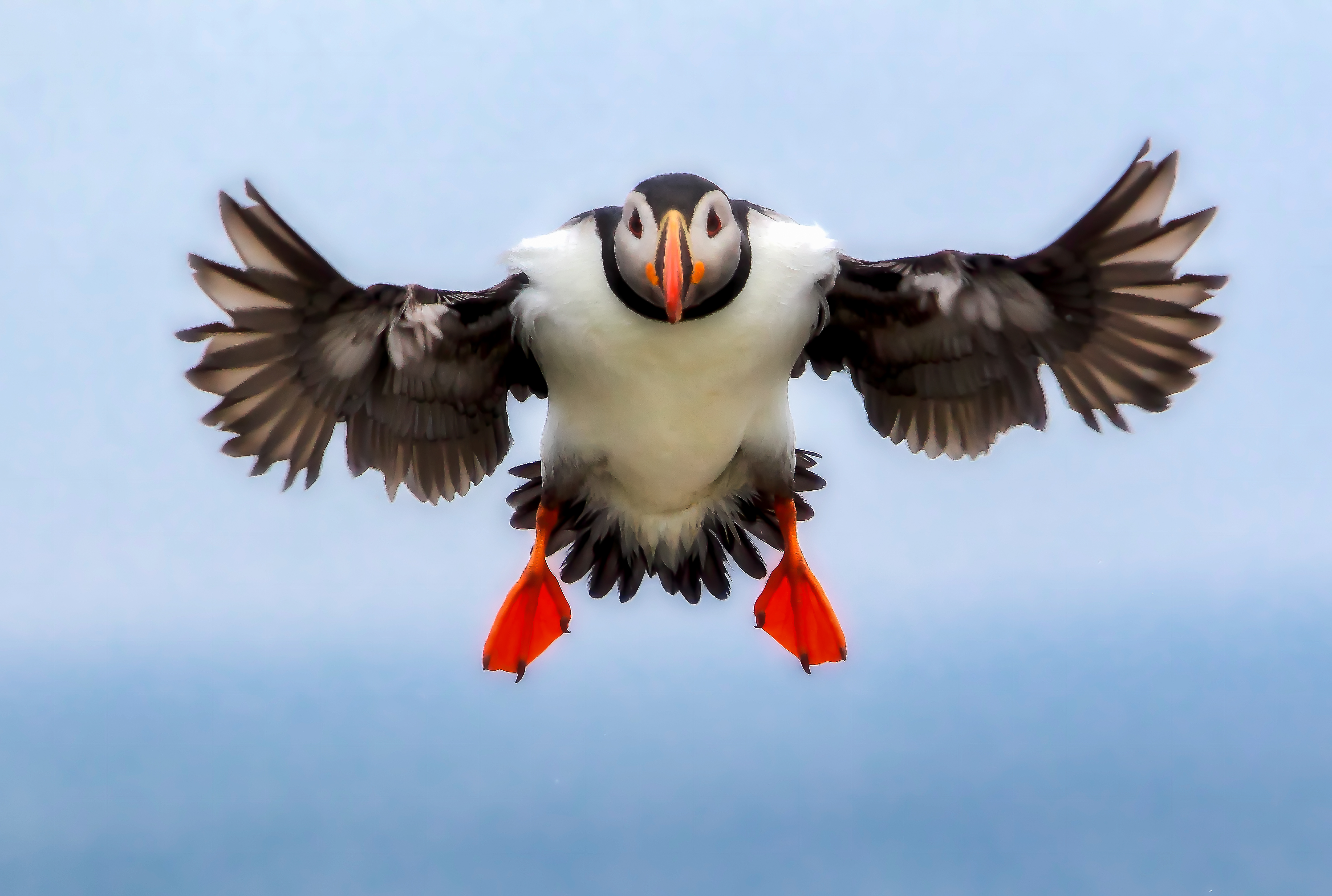
Machias Seal Island is one of those rare places where colony behavior, breeding season, and access windows all matter at once. This map helps you navigate a field setting shaped by nesting density, seabird behavior, and boat-based timing.
Best for: puffins, razorbills, nesting colonies, breeding behavior, and seasonal seabird observation
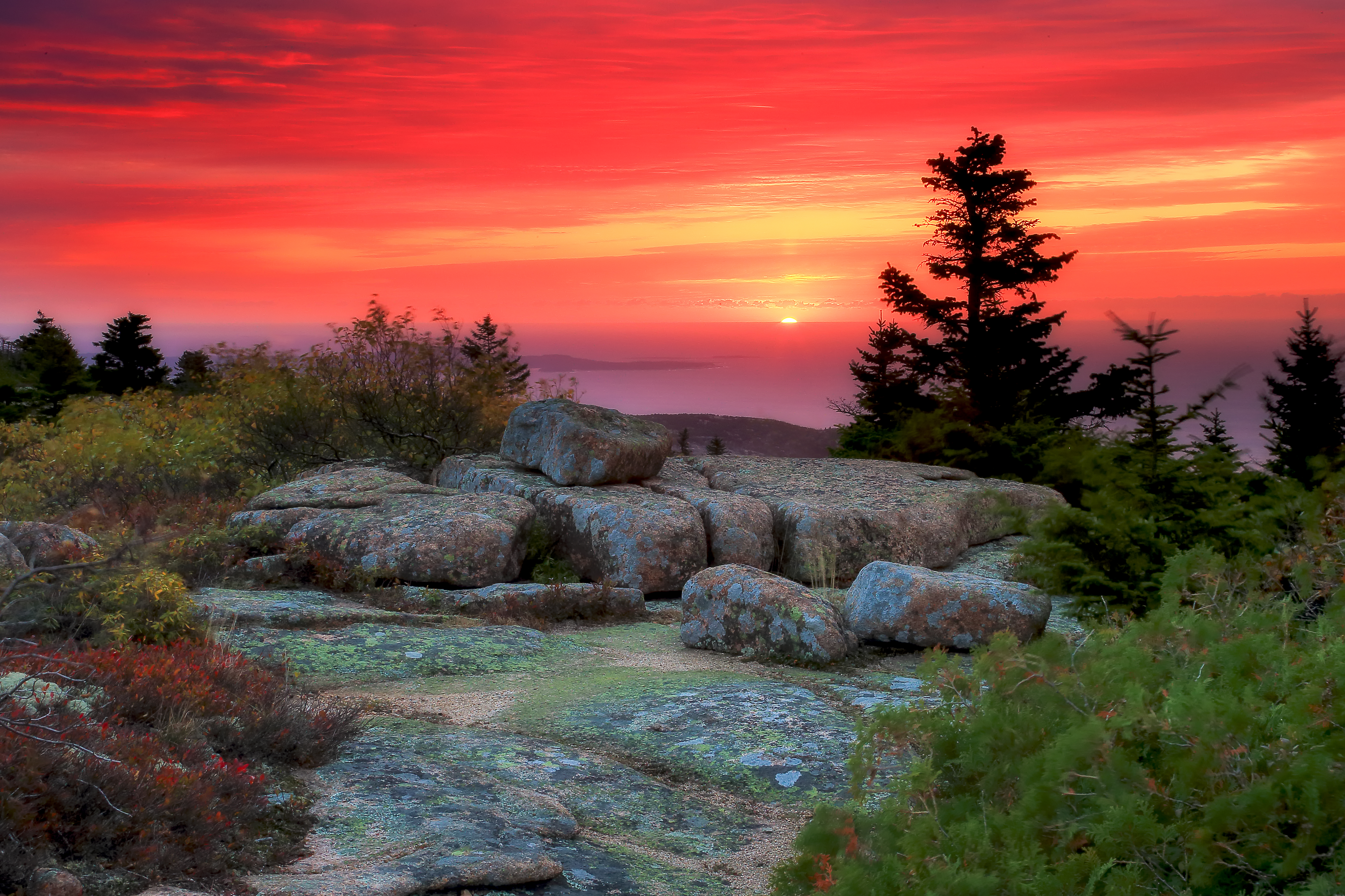
Cadillac Mountain is a place where landscape, timing, and atmosphere do the work together. This map highlights granite overlooks, coastal trail access, and sunrise positions that help you plan for changing cloud, fog, and first-light conditions.
Best for: sunrise planning, coastal landscape photography, elevation-based views, and shifting atmospheric conditions
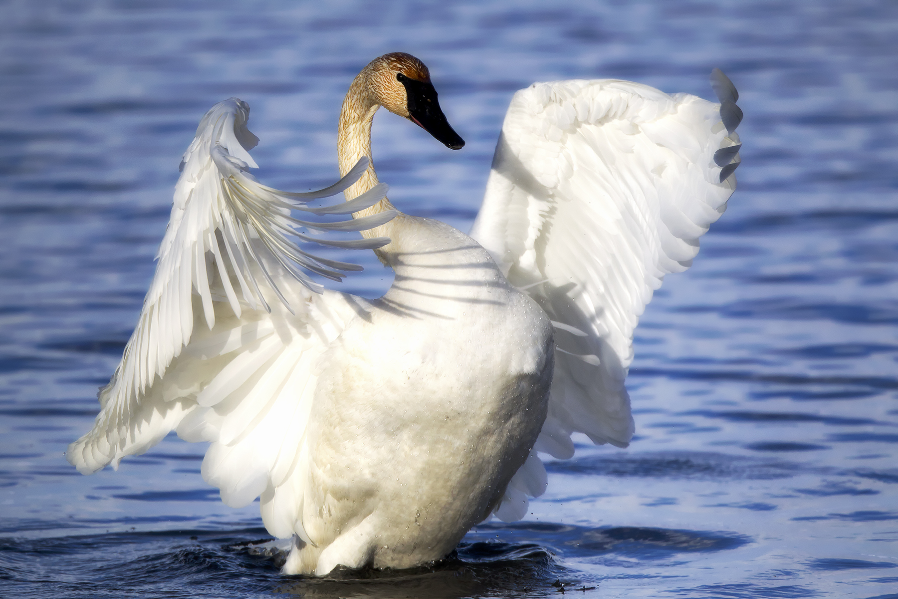
In winter, Lake Mattamuskeet becomes a gathering place for tundra swans, waterfowl, and raptors. This map focuses on blinds, wetland edges, road access, and reflective light conditions across one of the East Coast’s most important cold-season habitats.
Best for: tundra swans, winter waterfowl, wetland reflections, and refuge-based cold-season planning
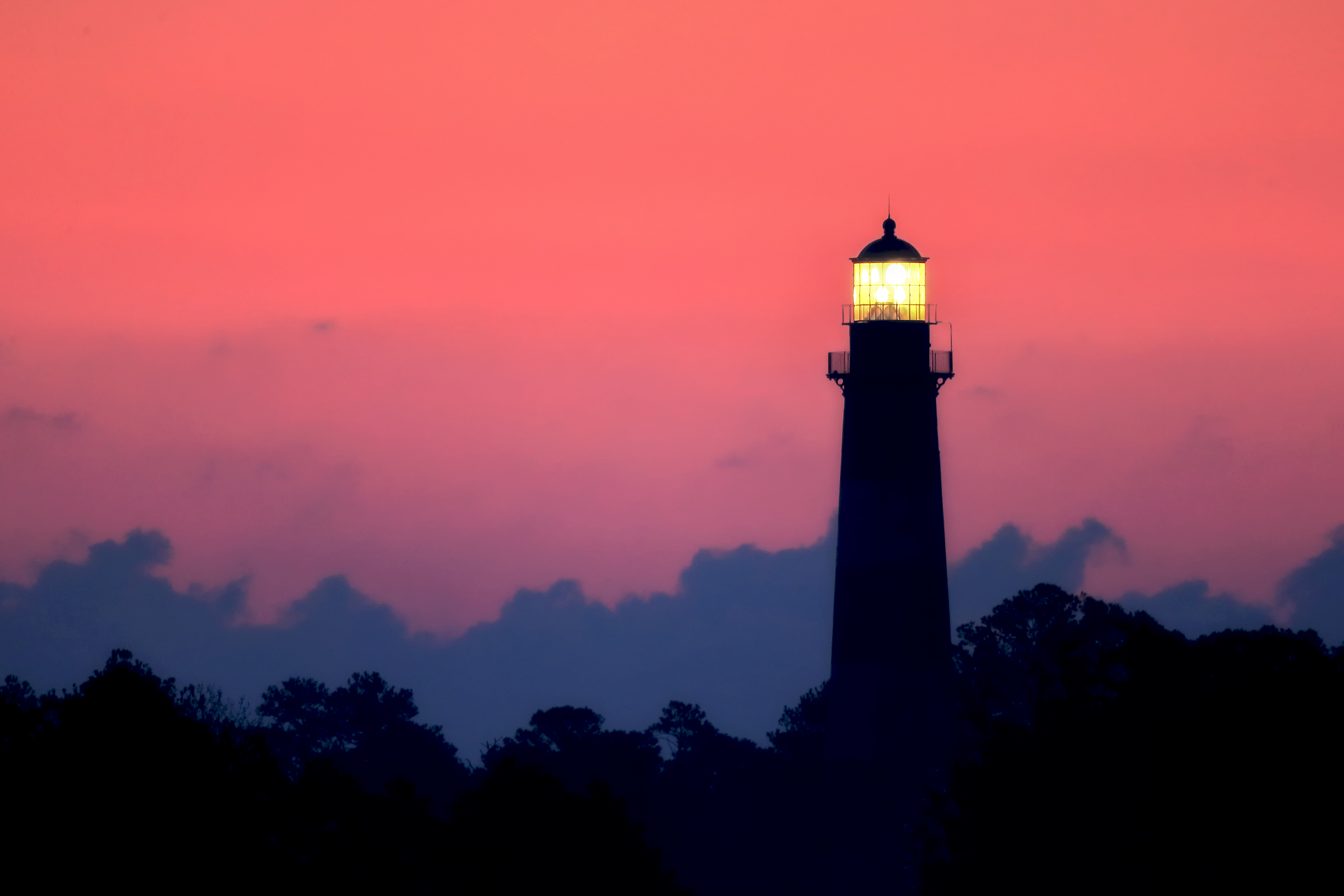
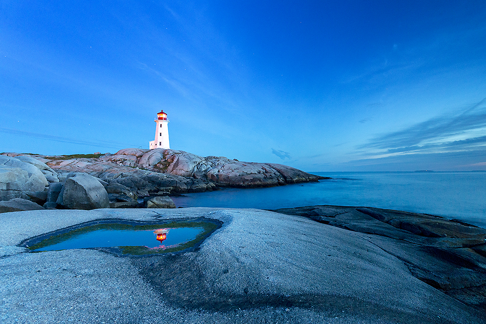
Peggy’s Cove is shaped by granite, Atlantic weather, and changing sea conditions. This map helps you work with fog windows, tidal rhythm, safe ledges, and lighthouse compositions in a place where seascape photography depends on caution as much as beauty.
Best for: fog, coastal atmosphere, lighthouse scenes, and safe seascape planning
Acadia brings together rugged coast, mountain overlooks, tide pools, and autumn color in one compact region. This map is designed for photographers planning around sunrise, trail access, coastal weather, and seasonal foliage.
Best for: coastal landscapes, autumn color, sunrise seascapes, and multi-location regional planning
Blackwater is a classic edge-ecology refuge—marsh, open water, forest, and sky all meeting at once. This map highlights wildlife drives, eagle zones, waterfowl habitat, and seasonal marsh concentrations across one of the Chesapeake’s most important refuge systems.
Best for: bald eagles, waterfowl, tidal marsh photography, and refuge road access
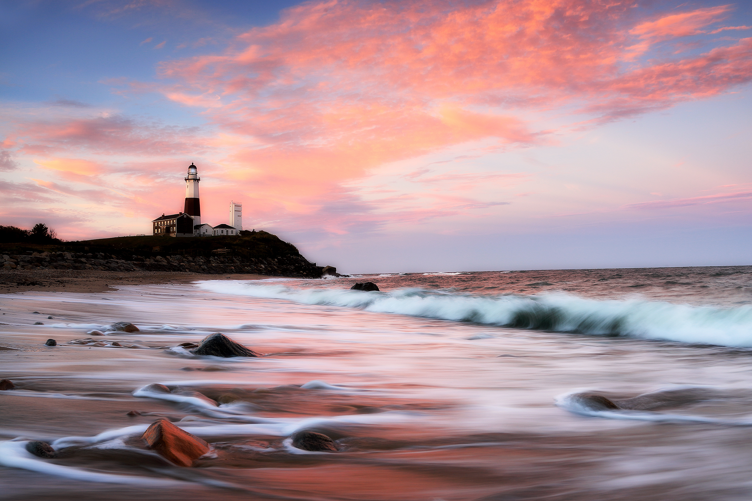
At the far eastern edge of New York, Montauk offers a dramatic mix of surf, bluffs, weather, and seasonal movement. This map helps you plan around striped bass blitz activity, fog conditions, and rugged shoreline access.
Best for: surf energy, coastal weather, dramatic shoreline light, and seasonal coastal movement
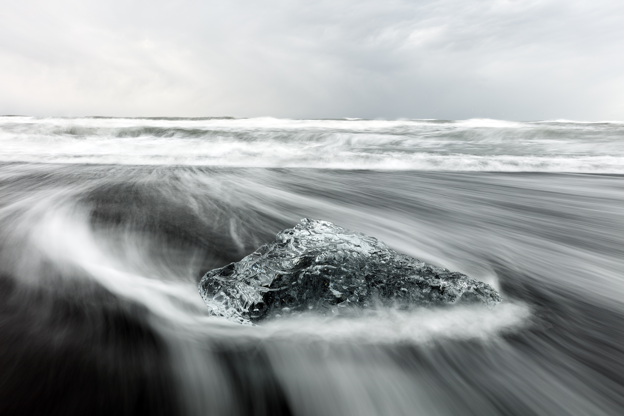
Iceland compresses weather, geology, and light into a landscape that changes quickly and often. This map is built for waterfalls, glaciers, geothermal zones, and northern lights planning, with an emphasis on field positioning and timing.
Best for: aurora planning, glacial landscapes, waterfalls, and extreme light conditions
Plan at Scale — Refuges, Parks, and Regional Photo Routes
Some trips begin with a single species or a single place. Others begin with a bigger question: where should I go this season, and what kind of wildlife or landscape experience am I trying to build around? These larger planning maps help connect individual destinations into broader field routes across refuges, national parks, migration zones, and seasonal opportunities.
Use them when you want to zoom out—whether you are building a wildlife-focused refuge trip, a multi-park landscape route, or a seasonal photography journey tied to migration, weather, and light. They pair especially well with the Seasonal Wildlife Calendar, Interactive Maps, and Field Tools.
The national wildlife refuge system protects some of the most important habitats for migratory birds, waterfowl, raptors, cranes, and wetland species in North America. This map helps you think beyond one stop at a time and instead plan across refuge networks where season, habitat, and wildlife concentration work together.
Best for: migration planning, refuge road trips, bird photography, and habitat-based field travel
From Yellowstone’s valleys to Acadia’s granite coast, the national parks offer a wider framework for planning photography around ecosystems, elevation, weather, geology, and seasonal access. This map is designed for photographers building larger routes across multiple parks rather than visiting only one destination in isolation.
Best for: multi-park trips, landscape photography planning, seasonal road routes, and ecosystem diversity
Naturepedia Connections — Go Deeper from Maps into the Larger System
These maps are one part of a larger field-based system. They help with location and planning, but they connect most strongly when paired with pages on wildlife behavior, ecosystems, migration timing, and the geography of observation itself. If you want to move beyond where to go and into why patterns appear where they do, these are the best next steps.
Together, these pages help connect place, season, habitat, behavior, and photographic opportunity into a more complete understanding of how the field actually works.
A deeper look at movement, feeding, breeding, habitat use, and behavioral adaptation—helping explain what you are actually seeing when timing and place align.
Places each map inside a larger ecological framework—wetlands, alpine systems, coasts, plains, forests, and other habitats that influence what becomes possible.
Use the planning layer alongside the practical layer, including timing tools, maps, seasonal guidance, and light-based resources for real field preparation.
Continue Planning — Align Location, Season, and Light
Once you have a location in mind, the next step is refining timing and conditions. Wildlife movement, seasonal change, weather, and light all work together, so the more precisely you align them, the more the field opens up.
These guides help move you from broad planning into real-world execution, whether you are following migration, tracking seasonal change, or preparing for a short window of light in a place you already know.
What is the best time of year for wildlife photography?
It depends on the behavior you want to observe. Spring is often best for migration and nesting, summer for long light and active ecosystems, autumn for rut and transition, and winter for tracking and concentrated movement. The Seasonal Wildlife Calendar helps match those seasonal windows to specific places and subjects.
Do these maps show exact photography locations?
Yes. Each map includes specific pullouts, blinds, trails, overlooks, or field-tested areas I’ve used or studied in relation to wildlife movement, seasonal timing, and photographic potential.
How should I combine maps with seasonal planning?
Start with the season or behavior you care about most, then use the maps to identify where those patterns are strongest. From there, refine your timing with tools like the Golden Hour & Moon Planner and the Seasonal Wildlife Calendar.
Are these locations suitable for beginners?
Many are accessible, especially national parks, established refuge roads, and well-known overlooks. Others require more awareness of tide, weather, terrain, or remote conditions. The best approach is to match the location to your experience level and season.
Can I plan a full photography trip using these resources?
Yes. The maps, seasonal guides, and field tools are designed to work together so you can build a trip around timing, habitat, light, and behavior rather than only around destination names.
1. What is the best time of year for wildlife photography?
It depends on the behavior you want to observe. Spring focuses on migration and nesting, summer on activity and long light, autumn on rut and transition, and winter on tracking and concentrated movement. Use the Seasonal Wildlife Calendar to align timing with specific species and locations.
2. Do these maps show exact photography locations?
Yes. Each map includes specific pullouts, blinds, trails, and vantage points I’ve used in the field, along with areas where wildlife movement or light patterns are most consistent.
3. How should I combine maps with seasonal planning?
Start with the season you’re targeting, then use the maps to identify where those patterns are strongest. From there, refine your timing using light tools like the Golden Hour & Moon Planner.
4. Are these locations suitable for beginners?
Many are accessible, but conditions vary. National parks and refuges often provide easy entry points, while coastal and remote areas require more awareness of terrain, weather, and safety.
5. Can I plan a full photography trip using these resources?
Yes. Combine the maps, seasonal guides, and field tools to build a trip around location, timing, and behavior rather than just destinations. That approach leads to more consistent results in the field.
About the Author
Robbie George is a National Geographic-published nature photographer who has spent years documenting wildlife, landscapes, migration patterns, and seasonal change across North America—from Yellowstone and Grand Teton to Atlantic refuges, coastal wetlands, and northern seabird colonies.
His work is built on time in the field—watching how animals move through habitat, how light changes across terrain, and how weather and season shape what becomes possible in a place. These maps and planning guides come directly from that experience, designed to help others move through the same landscapes with greater clarity and intention.
Beyond photography, Robbie is the creator of Naturepedia, a field-based knowledge system connecting wildlife, ecosystems, geography, and seasonal timing. That larger structure helps place individual locations into a broader understanding of how nature behaves across real landscapes.
The presence of this badge signifies that this business has officially registered with the Art Storefronts Organization and has an established track record of selling art.
It also means that buyers can trust that they are buying from a legitimate business. Art sellers that conduct fraudulent activity or that receive numerous complaints from buyers will have this badge revoked. If you would like to file a complaint about this seller, please do so here.
Verified Returns & Exchanges
The Art Storefronts Organization has verified that this business has provided a returns & exchanges policy for all art purchases.
Description of Policy from Merchant:
What is your Policy on Returns/Exchanges/Refunds?
I take great pride in my work and prints, and I want you to be completely happy with your investment in my nature art. If for any reason you are unsatisfied with your print, you may return it within 14 days of delivery, and/or exchange it for another print. Prints must be returned in new condition, packaged carefully in the original packaging if possible. Your refund will be issued as soon as I receive the returned print. Please contact me if you would like to arrange a return or exchange.
In the event that you receive a damaged or defective print, please let me know within 7 days of receipt, and I will arrange for a new print to be shipped to you at no additional cost.
Verified Secure Website with Safe Checkout
This website provides a secure checkout with SSL encryption.
Verified Archival Materials Used
The Art Storefronts Organization has verified that this Art Seller has published information about the archival materials used to create their products in an effort to provide transparency to buyers.
Description from Merchant:
Fine Art Prints are made with high-quality archival inks on fine art papers using a high-resolution large format inkjet printer. Our premium archival inks produce images with smooth tones and rich colors. Prints are made with care on your choice of exquisite Fine Art Papers using a high-resolution large format inkjet printer. https://www.graphikprintworks.com
Become a supporter of Robbie George Photography and be the first to receive new content and special promotions.
“Every image is a field. Every quote is a key. Welcome back to the rhythm.” ~Robbie
Cart
Your cart is currently empty.
Saved Successfully.
This is only visible to you because you are logged in and are authorized to manage this website. This message is not visible to other website visitors.
Import From Instagram
Click on any Image to continue
This Website Supports Augmented Reality to Live Preview Art
This means you can use the camera on your phone or tablet and superimpose any piece of nature art onto a wall inside of your home or business.
To use this feature, Just look for the "Live Preview AR" button when viewing any piece of nature art on this website!