Grand Teton Wildlife System — Timing, Habitat, and Field Execution
Where mountains, wetlands, rivers, and valley floors compress wildlife movement into one of North America’s most readable field systems
How to Use This Grand Teton Wildlife System
This is not a travel guide.
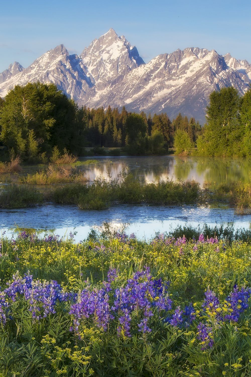
Grand Teton is a compressed mountain-valley wildlife system where rivers, wetlands, willow flats, forest edges, meadows, and elevation shifts shape how animals move. This page is designed to help you read that system in the field.
This page is part of the larger Naturepedia system, and works directly with the Seasonal Wildlife Calendar and Field Tools.
Instead of asking “Where should I go in Grand Teton?”, the stronger field question is:
What species → what habitat edge → under what seasonal timing → in what light → with what field position?
That is how Grand Teton becomes readable. Moose often connect to wetlands, willow flats, and river edges. Elk respond to open meadows, forest cover, rut timing, and migration pressure. Bears follow food sources, slopes, forest edges, and seasonal emergence patterns.
Grand Teton changes across the seasonal cycle:
- Spring — Emergence: wetland activity, bear emergence, newborn wildlife, and fresh movement
- Summer — Expression: flowers, river corridors, feeding, insects, and early/late light
- Autumn — Transition: elk rut, moose rut, bear feeding, and migration pressure
- Winter — Compression: tracks, lower-elevation movement, snow patterns, and energy conservation
Grand Teton is not random. It is a readable edge system—mountain to valley, forest to meadow, river to wetland, cover to opening. Once you understand those edges, field decisions become more intentional.
Primary Species Signals in Grand Teton
Grand Teton is a habitat-edge system. Wildlife here is best understood through how species use wetlands, rivers, forests, meadows, and elevation changes.
Behavior: browsing, slow movement, wetland feeding
Timing: dawn, dusk, autumn rut, winter browse
Habitat: willow flats, wetlands, river edges
Behavior: herd movement, rut, migration
Timing: autumn rut, winter valleys, spring movement
Habitat: meadows, forest edges, valley floors
Behavior: feeding, roaming, slope movement
Timing: spring emergence, fall feeding
Habitat: slopes, forest edges, meadows
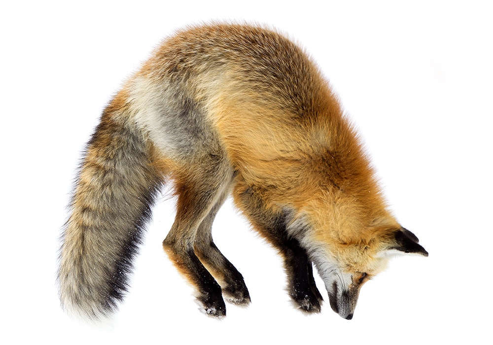
Behavior: hunting, listening, opportunistic feeding
Timing: dawn/dusk, winter snowfields
Habitat: open meadows, edges, flats
Field insight: Grand Teton wildlife is defined by edges—wetland to forest, river to meadow, slope to valley. Focus on where habitats meet.
Habitat Zones Within Grand Teton
Grand Teton is a layered mountain-valley system. Wildlife movement is shaped by elevation, water, vegetation, and seasonal change.
Willow Flats & Wetlands
Core moose habitat. Dense vegetation, water access, and feeding zones create predictable movement patterns.
River Corridors
The Snake River and tributaries concentrate wildlife movement, tracks, crossings, and feeding activity.
Meadows & Valley Floors
Open areas where elk, bison (occasionally), and coyotes move, feed, and interact under changing light conditions.
Forest Edges
Transition zones where animals move between cover and feeding areas—strong during dawn, dusk, and weather changes.
Mountain Slopes
Bears, elk, and other species move along slopes and elevation gradients based on season and food availability.
Habitat insight: The strongest wildlife encounters happen where these zones intersect—wetland to forest, river to meadow, slope to valley.
Grand Teton Wildlife Timing Engine
Grand Teton wildlife is shaped by season, elevation, light, water, and habitat edges. The strongest field opportunities happen when timing and habitat overlap.
Spring — Emergence
Wetlands wake up, bears emerge, elk and moose movement increases, and fresh tracks appear along muddy edges and river corridors.
Summer — Expression
Wildflowers, insects, water, and green vegetation concentrate feeding. Wildlife is most active during cool dawn and dusk windows.
Autumn — Transition
Elk and moose rut behavior intensifies, bears feed heavily, and animals begin shifting toward lower-elevation patterns.
Winter — Compression
Snow exposes tracks, animals conserve energy, and movement compresses into valleys, river edges, willow zones, and wind-scoured openings.
Daily Movement Windows
- Dawn: strongest window for moose, elk, bears, coyotes, reflection light, mist, and quiet wetland movement
- Dusk: strong secondary movement window as animals leave cover and return to feeding areas
- Midday: best for scouting habitat edges, distant slopes, water levels, tracks, and next-position planning
Environmental Triggers
- Fog & Mist: strengthens wetland, river, and mountain-reflection scenes
- Cold Mornings: increase visible breath, activity, and low-elevation movement
- Water Levels: shape crossings, feeding edges, track visibility, and reflection conditions
- Fresh Snow: reveals travel corridors, browse patterns, bedding areas, and predator movement
- Fall Color: aligns rut behavior with visual habitat structure and stronger storytelling conditions
Timing principle: Grand Teton becomes readable when season, water, elevation, light, and habitat edge all align. The strongest field moments are rarely isolated—they are timed intersections.
Tracking & Movement in Grand Teton
Grand Teton’s tracks and movement signs are strongest where water, willow flats, forest cover, and open meadows meet. These signs help reveal how wildlife moves before animals are visible.
Where Tracks Are Most Visible
- Wetland edges: moose, deer, beaver, birds, and smaller mammals leave patterns in mud and soft ground
- Willow flats: browse trails, broken stems, bedding signs, and moose movement corridors appear over time
- River banks: crossings, feeding zones, and travel routes concentrate along the Snake River and side channels
- Snow-covered meadows: winter reveals elk, moose, coyote, fox, and predator-prey movement patterns
- Forest edges: repeated trails show how animals move between cover and feeding habitat
What Movement Patterns Mean
- Moose browse lines: indicate repeated willow use and likely return zones
- Elk trails: reveal herd movement between meadows, forest cover, and seasonal corridors
- Bear sign: feeding areas, overturned material, scat, or slope movement may indicate seasonal food use
- Coyote routes: often follow meadow edges, snowfields, roadsides, and small-mammal concentration zones
Field Application
Tracking in Grand Teton is less about following animals and more about recognizing repeat use. The strongest field decisions come from identifying where animals repeatedly cross, feed, browse, bed, or move between habitat edges.
- Use tracks to identify direction, freshness, and repeated travel routes
- Watch willow edges for moose browse and bedding patterns
- Use river corridors to anticipate crossings and early-morning movement
- Combine track evidence with light, season, and wind before choosing position
Tracking principle: Grand Teton’s wildlife routes are written along edges—river edge, willow edge, forest edge, meadow edge. Read those edges and movement becomes easier to anticipate.
Grand Teton Field Strategy
Grand Teton rewards quiet positioning and patience along habitat edges. The strongest images happen when light, water, terrain, and wildlife behavior align naturally.
Light & Reflection
Early morning and late evening light create reflections across rivers, ponds, and wetlands. Calm water, fog, and low-angle light amplify depth, color, and atmosphere.
Edge Positioning
Work along edges—willow to water, forest to meadow, river to bank. These transition zones are where wildlife movement becomes predictable.
Stay Ahead of Movement
Use tracks, browse patterns, water crossings, and repeated paths to position before animals arrive. Movement is often slow and repeatable in this system.
Ethical Observation
Maintain distance, avoid pressure, and allow wildlife to move naturally. Moose, bears, and elk require space—your position should never alter behavior.
Repeat Patterns
Return to the same wetland, river bend, or meadow under different conditions. Grand Teton reveals patterns through repetition, not one-time encounters.
Execution principle: Grand Teton is a system of alignment—light, water, edge, and behavior. When these elements compress into the same moment, the scene reveals itself.
Grand Teton Sub-Locations as Field Systems
Grand Teton becomes more readable when broken into smaller field systems. Each area has distinct habitat structure, species signals, and timing patterns.
Schwabacher Landing
Wetland and river-edge system known for moose habitat, reflections, calm water, and early morning mist conditions.
Oxbow Bend
Snake River bend that concentrates waterfowl, moose, elk, and reflection-based compositions under strong light conditions.
Snake River Corridor
Major wildlife movement channel with crossings, feeding zones, track visibility, and layered habitat edges.
Willow Flats
Core moose browsing system where dense vegetation, water, and edge habitat create repeatable movement patterns.
Antelope Flats
Open meadow system supporting pronghorn, elk, coyotes, and expansive landscape compositions with mountain backdrops.
Forest & Slope Edges
Transition zones where bears, elk, and deer move between cover and feeding areas along elevation gradients.
Location principle: Grand Teton is best understood through edge systems—river to land, forest to meadow, slope to valley. Break the landscape into these smaller systems to predict wildlife movement.
Naturepedia Connections
Grand Teton is part of a connected wildlife system. These links expand your understanding of species behavior, ecosystems, seasonal timing, tracking, and field execution across Naturepedia.
System principle: Grand Teton is one node in a connected network. The more you connect species, habitat, timing, and behavior, the more predictable wildlife becomes.
About the Author
Robbie George is a National Geographic–published wildlife photographer, field observer, and the creator of Naturepedia—a system designed to understand how species, behavior, habitat, and time connect in the real world.
His work in places like Grand Teton is shaped by direct field observation—studying how mountains, rivers, wetlands, willow flats, and seasonal light influence wildlife movement.
Rather than treating wildlife photography as chance encounters, Robbie approaches the field as a system—aligning species, habitat, timing, behavior, and ethical positioning so the moment unfolds naturally.
Grand Teton Wildlife Photography FAQ
When is the best time to see moose in Grand Teton?
Moose are most active at dawn and dusk in wetlands and willow flats. Autumn rut and winter browsing periods provide especially strong visibility.
Where are the best wildlife areas in Grand Teton?
Key areas include Schwabacher Landing, Oxbow Bend, Willow Flats, Snake River corridors, and open meadow systems like Antelope Flats.
What makes Grand Teton different from Yellowstone?
Grand Teton is a more compressed, edge-based system where wetlands, forests, and mountains meet. Wildlife movement is often easier to read because habitats are tightly connected.
Is Grand Teton good for wildlife photography?
Yes—especially for moose, elk, bears, and river-based wildlife. The combination of mountains, water, and edge habitat creates strong opportunities for both behavior and composition.
How should photographers approach wildlife in Grand Teton?
Use distance, avoid pressure, and position along habitat edges. Let wildlife move naturally through the scene rather than approaching too closely.